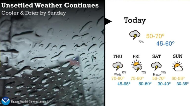
More thunderstorms, showers still possible through rest of the week
After a night of thunderstorms, the National Weather Service predicts more today, Friday, and Saturday. Drier weather is expected to return on Sunday.


After a night of thunderstorms, the National Weather Service predicts more today, Friday, and Saturday. Drier weather is expected to return on Sunday.
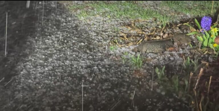
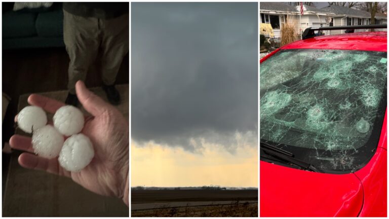
Hail fell in parts of Champaign and Vermilion Counties on Thursday night.
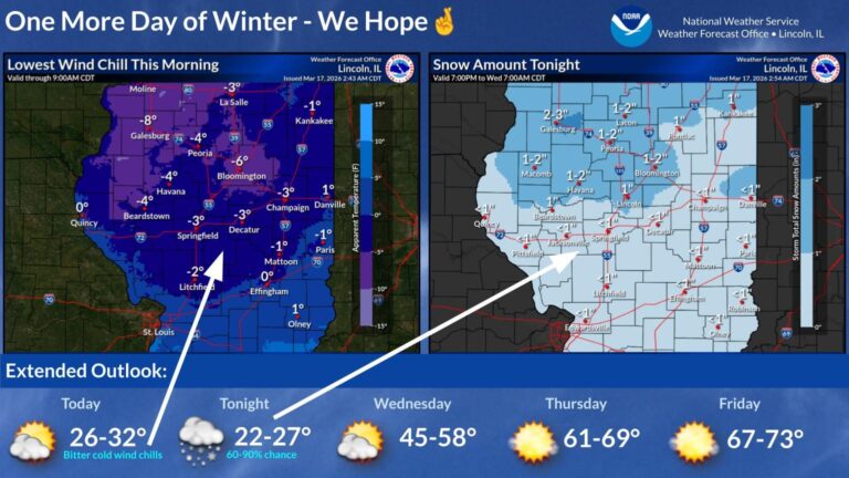
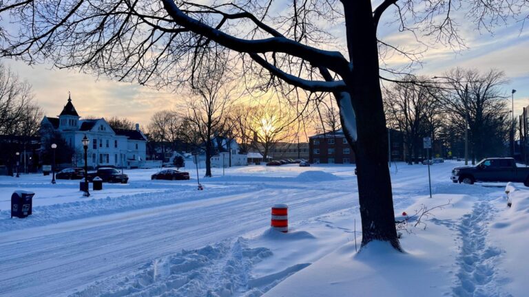
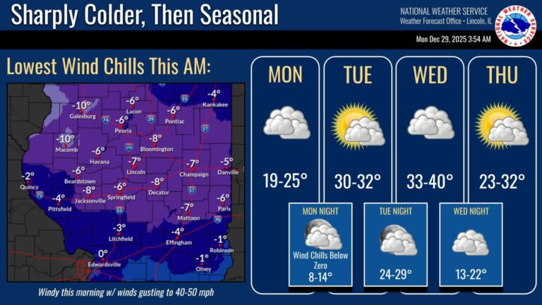
Wind chills of 5-10 degrees below zero are expected overnight. Another burst of snow is forecast for Tuesday night.
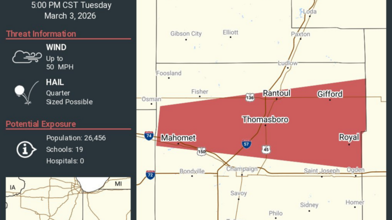
Tornado Watch for Champaign, DeWitt, Logan, Macon, Menard, Piatt, Sangamon and Vermilion Counties until Wednesday at 2am.
Meteorologist Andrew Pritchard said that hail up to an inch in diameter is a possibility.
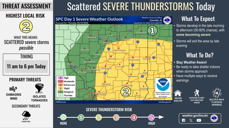
Severe thunderstorms remain on track for today. Locally damaging wind gusts and a few tornadoes are the primary concerns
The groundhog predicted 6 more weeks of winter. So does Illinois’ climatologist.
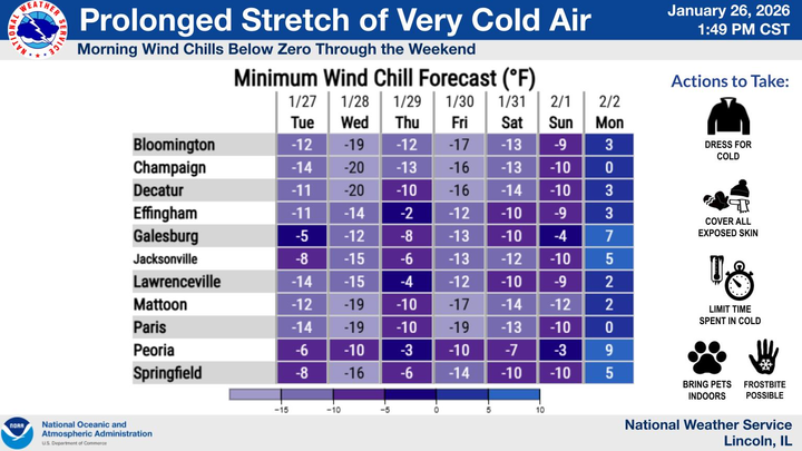
Temperatures will be in the teens through Saturday with “dangerously cold wind chills” ranging from -10 to -20.
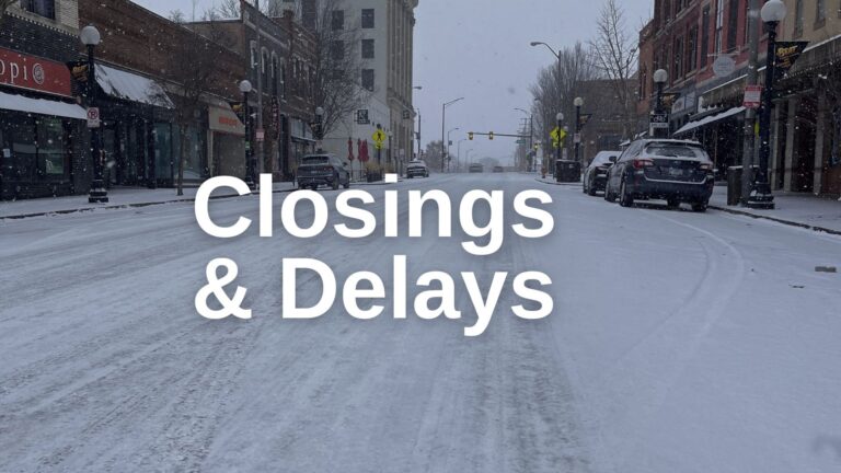
A list of school closing and weather-related announcements for several counties in Central Illinois.
Snow will continue across central and southeast IL this morning, with periods of heavy snow near and south of I-70 in southeast IL. North winds gusting 20 to 30 mph will create blowing and drifting in open areas.
If you want to share your pictures, send them to willnewsroom@illinois.edu
A list of closing and weather-related announcements for several counties in Central Illinois.
A list of school closing and weather-related announcements for several counties in Central Illinois.
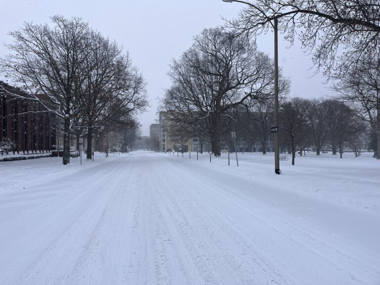
After severe storms and a cold front passed through Central Illinois, the National Weather Service said wind chills are expected to drop below zero again late Monday night and heading into Tuesday morning.

National Weather Service: a strong cold front on Sunday could produce severe storms with isolated damaging winds, isolated tornadoes, and small hail.