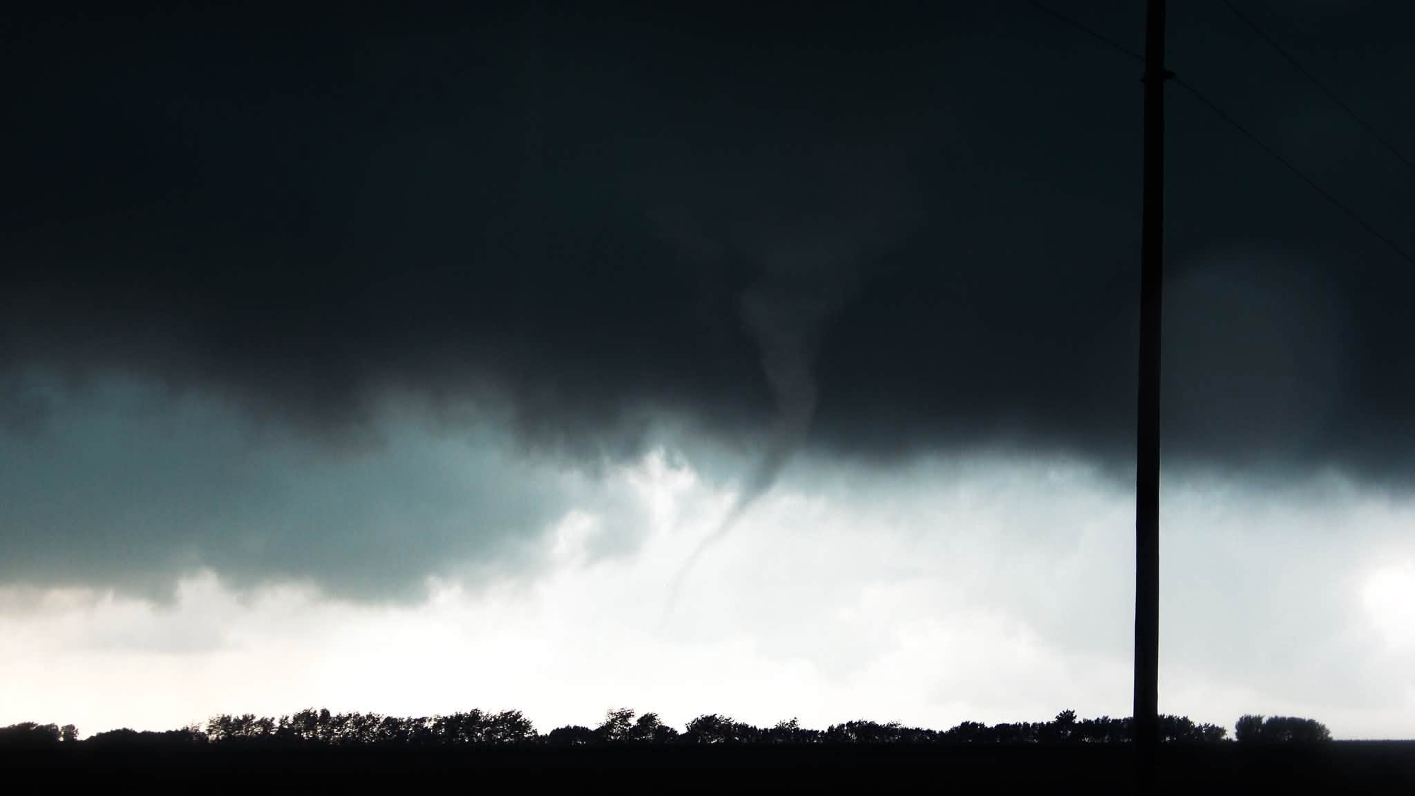
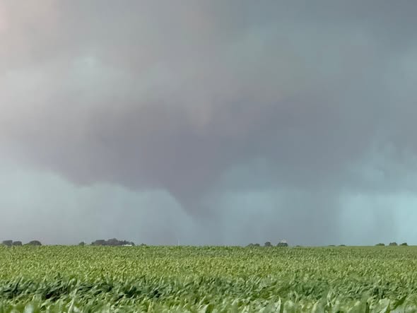
Tornado spotted and wind damage reported in central and southeast Illinois
For Breaking Weather Updates, tune to WILL-AM 580, Illinois Classical FM 90.9, and Illinois Soul FM 101.1.


For Breaking Weather Updates, tune to WILL-AM 580, Illinois Classical FM 90.9, and Illinois Soul FM 101.1.

Illinois Public Media Meteorologists Ed Kieser and Andrew Pritchard are working to provide forecasts and breaking weather.
For instant weather warnings, listen to WILL-AM 580, WILL-FM 90.9 and Illinois Soul FM 101.1.
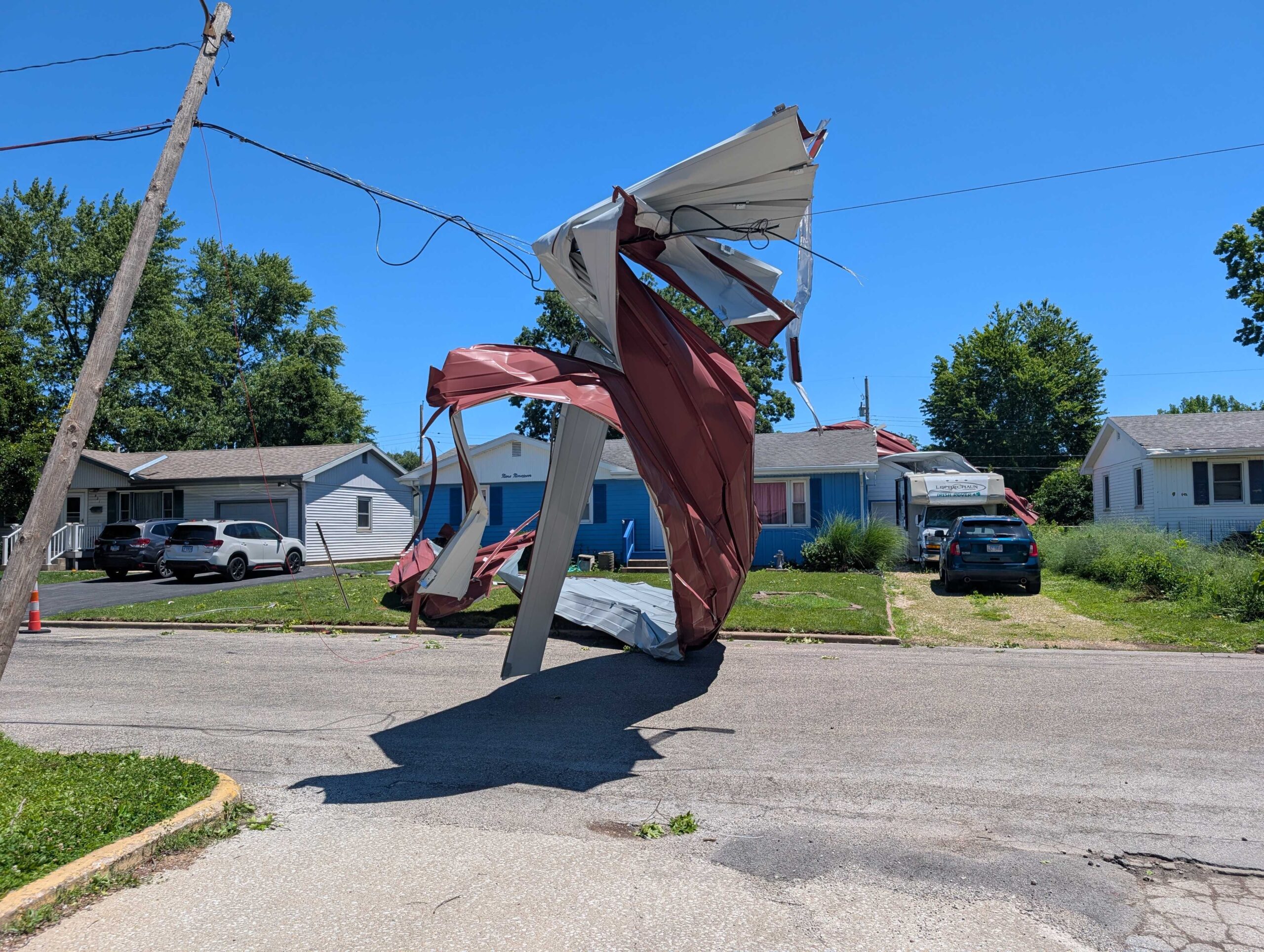
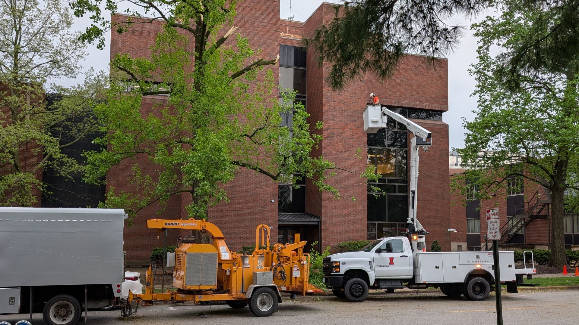
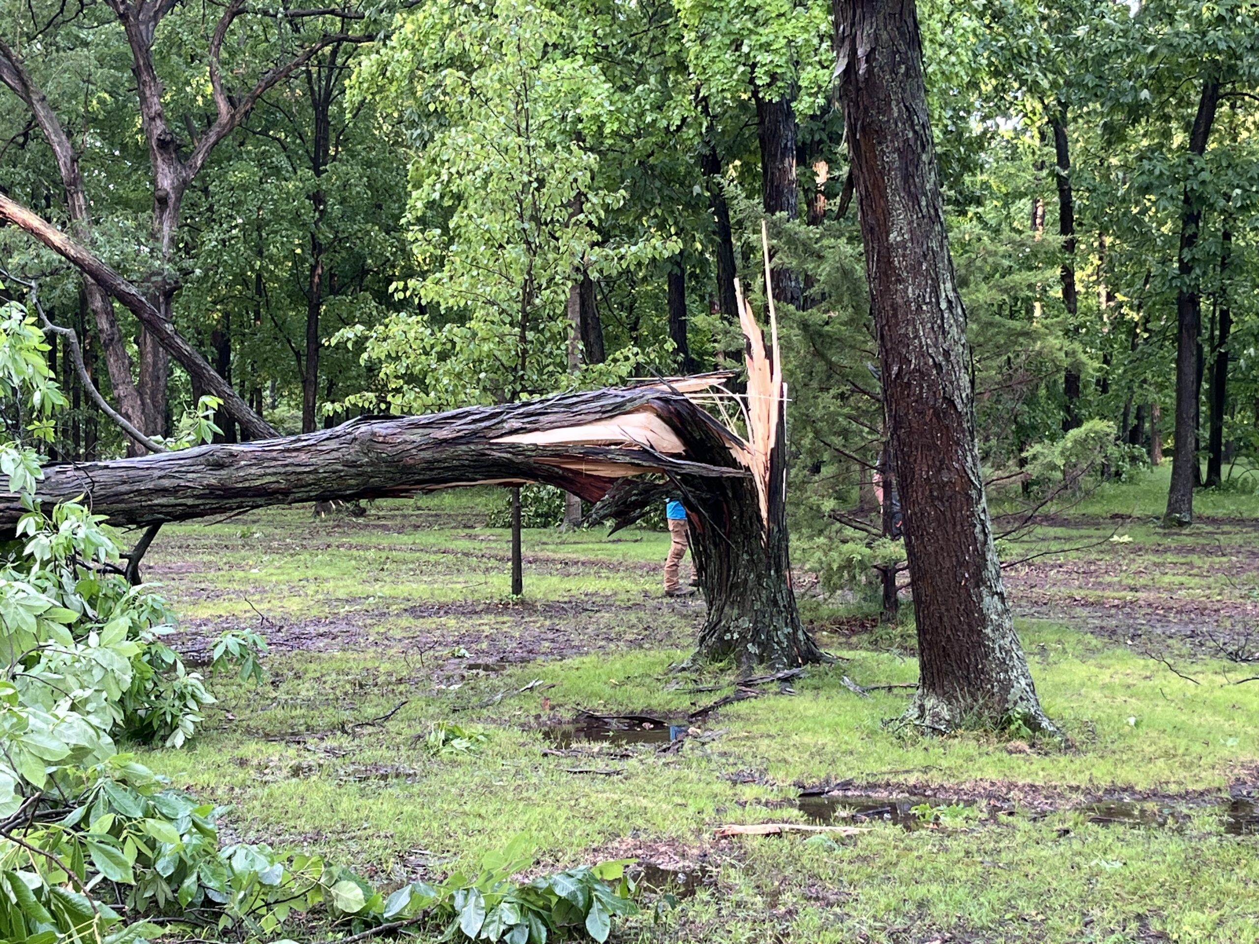
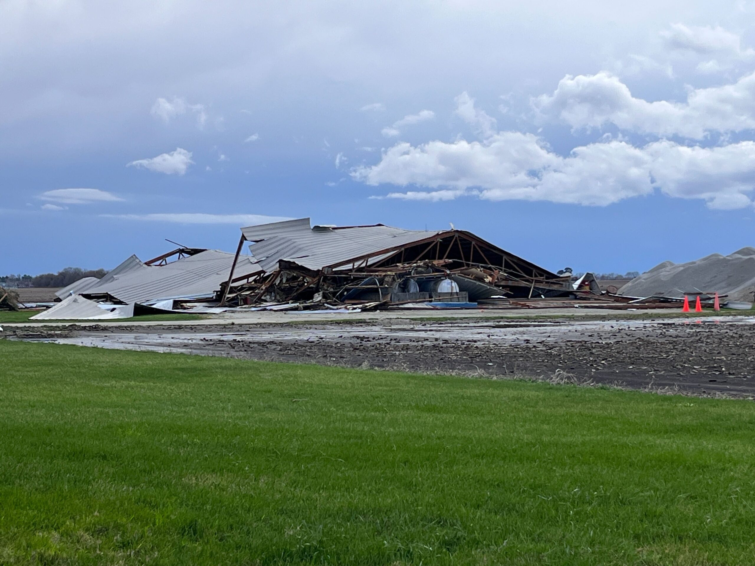
Cleanup underway in Champaign and Vermilion Counties after storms on June 12, 2026. Photos by Abigail Bottar and Reginald Hardwick, IPM News
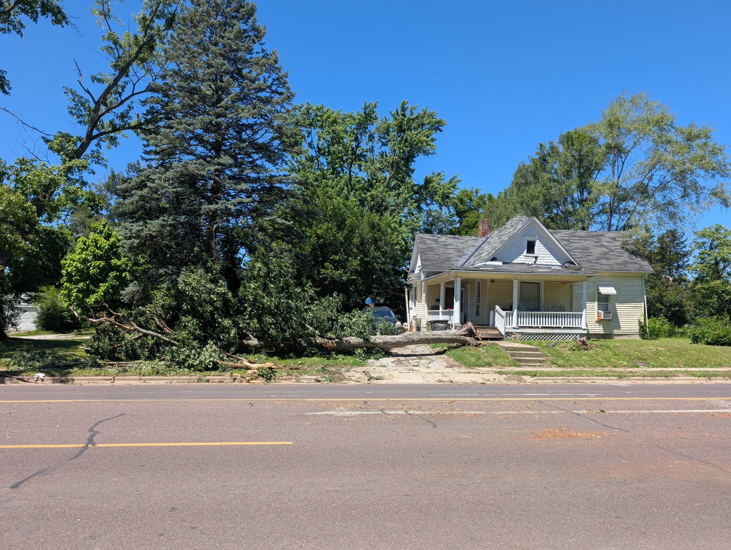
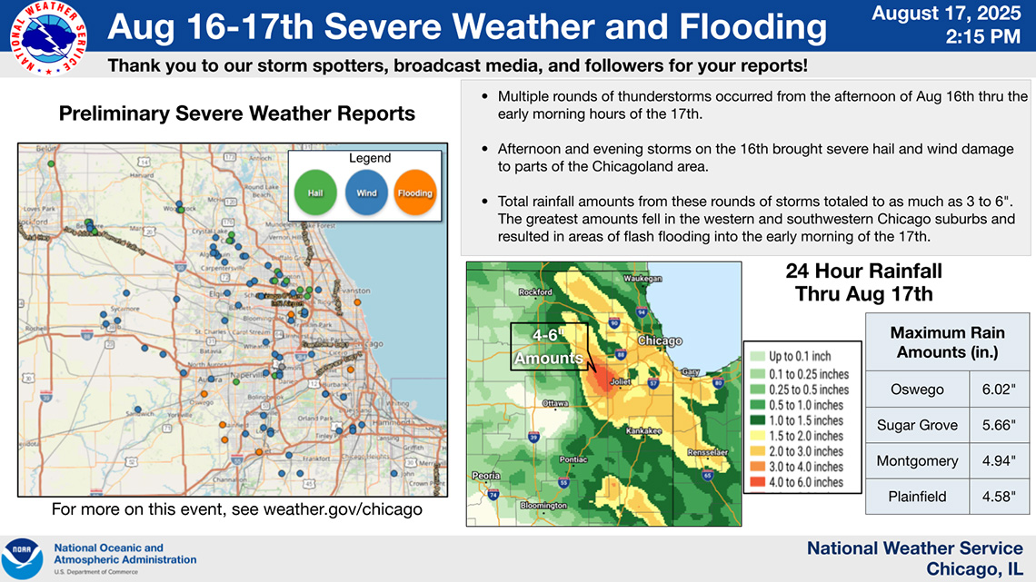
Major damage reported in Champaign and Vermilion Counties after heavy winds and rain passed through Thursday night.
Many places in Central Illinois are cleaning up after two rounds of severe storms Monday.
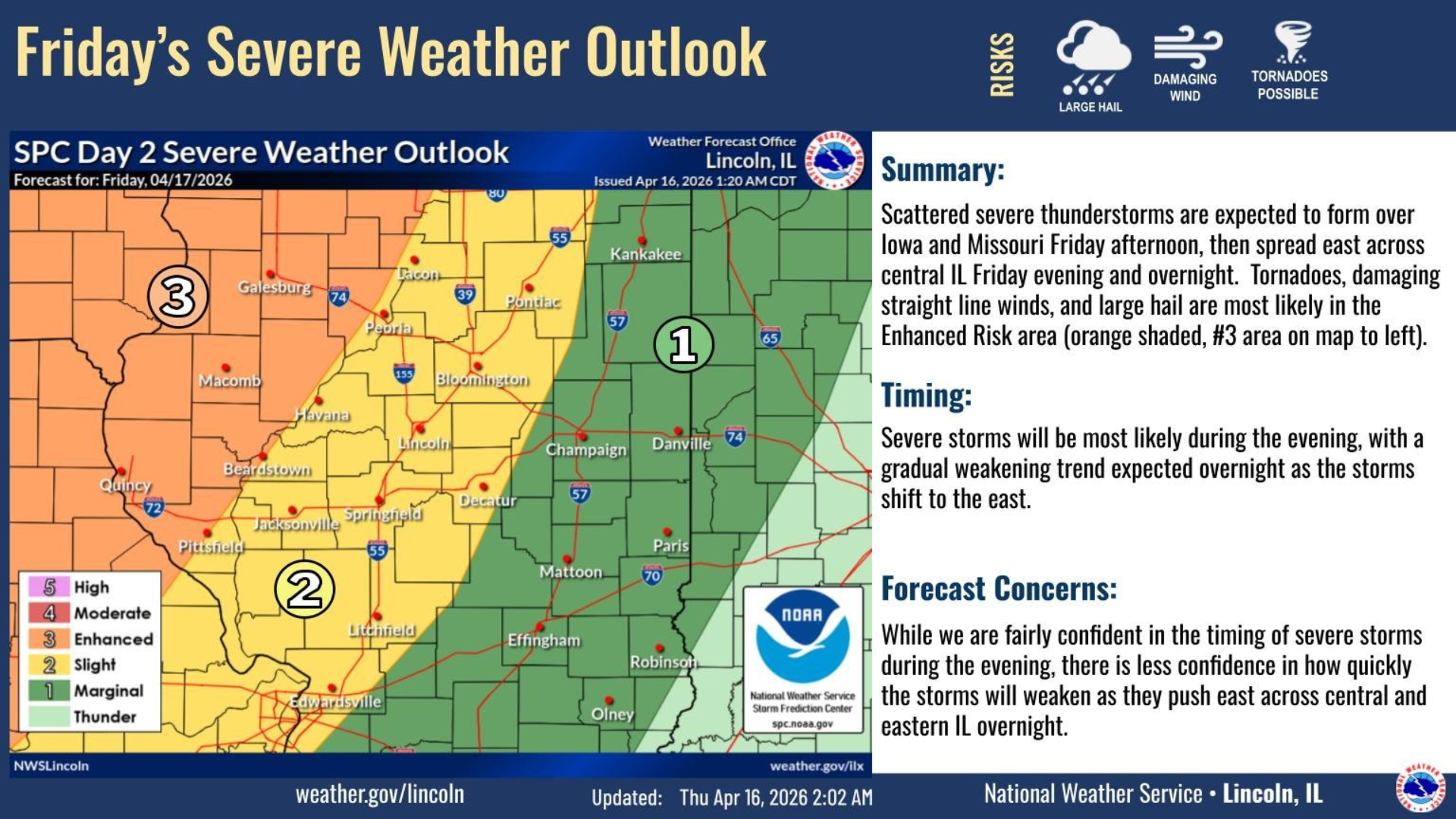
Scattered showers and thunderstorms will continue today. Temperatures are expected to dip this weekend.
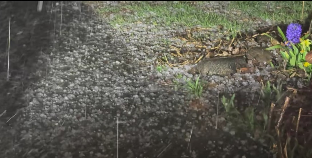
Hail fell in parts of Champaign and Vermilion Counties on Thursday night.
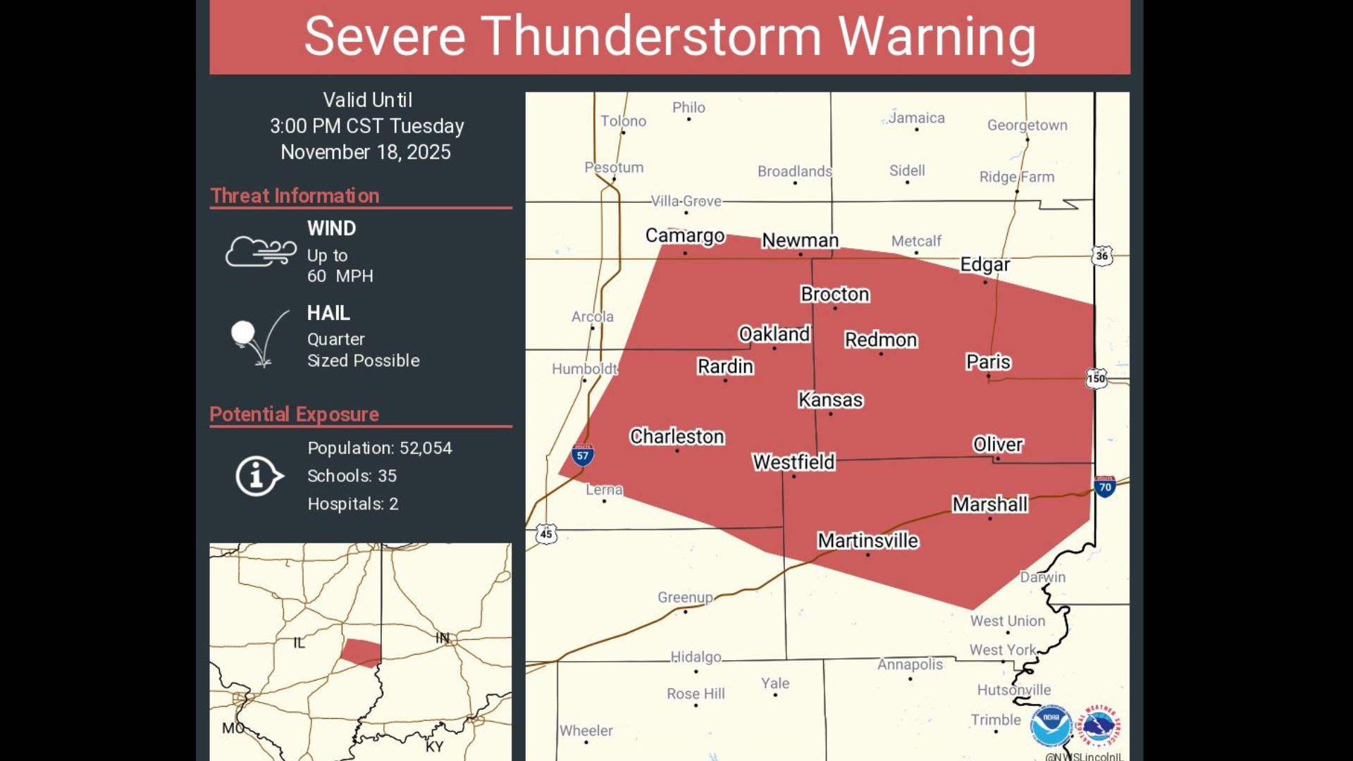
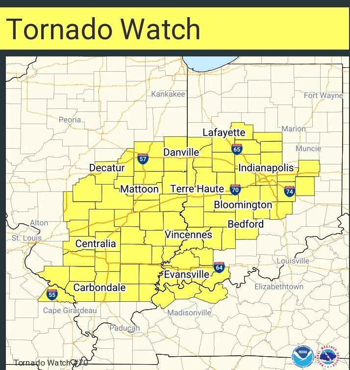
Tornado Watch for Champaign, DeWitt, Logan, Macon, Menard, Piatt, Sangamon and Vermilion Counties until Wednesday at 2am.
Meteorologist Andrew Pritchard said that hail up to an inch in diameter is a possibility.
The agency said supplemental assistance from the federal government wasn’t warranted.
Residents are advised to move to an interior room on the lowest floor of a building for safety precautions.
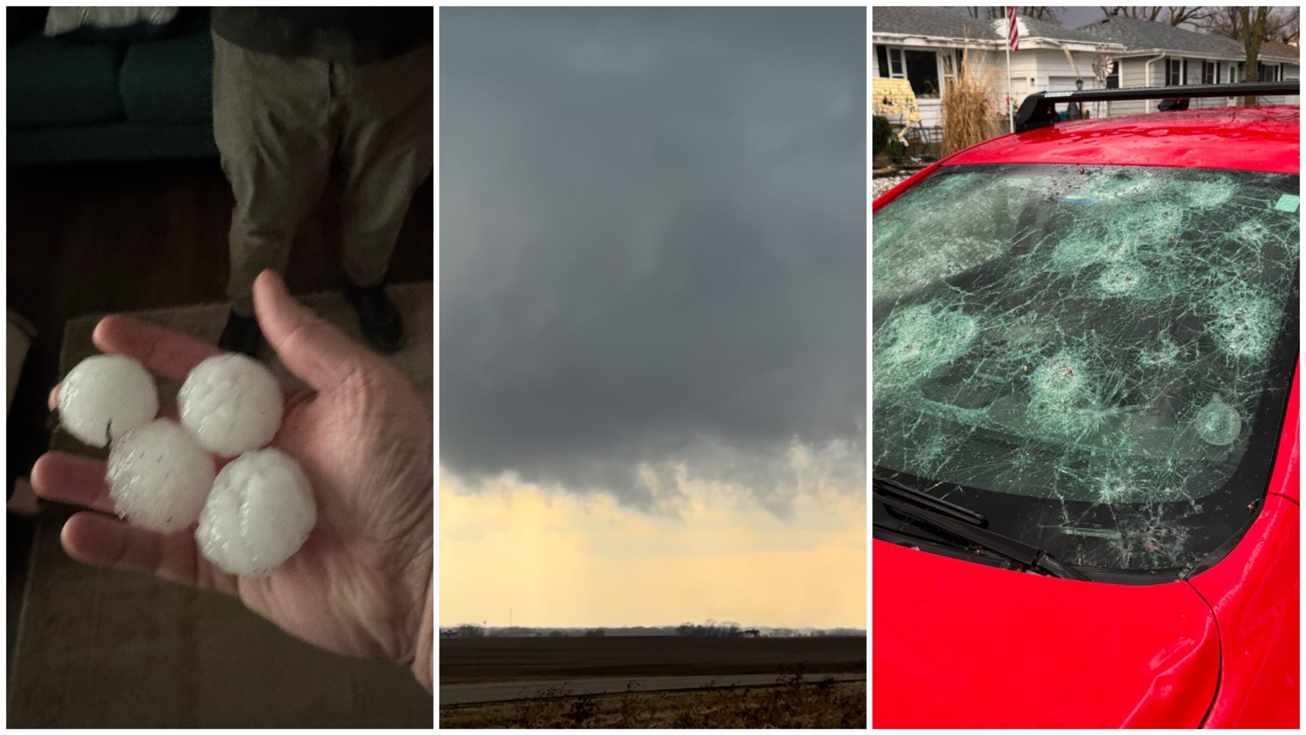
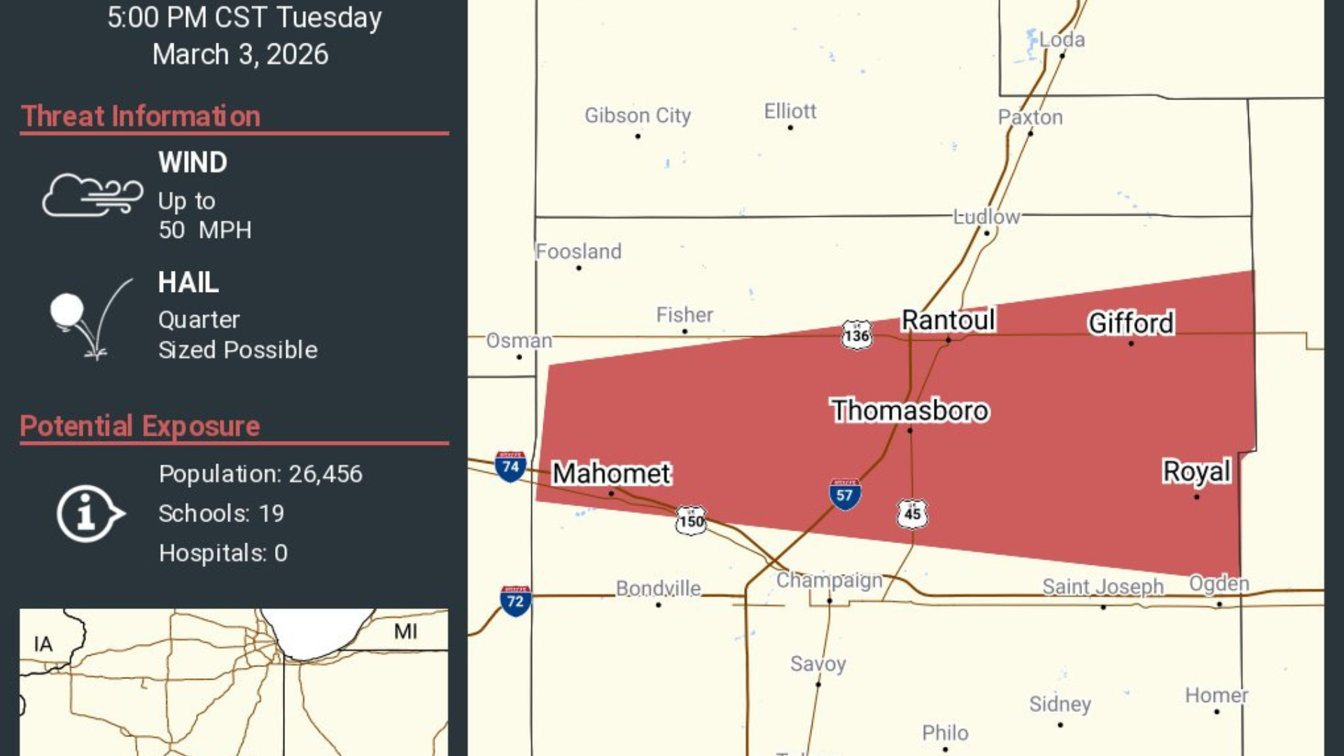
Tornado warnings were issued at different times Tuesday afternoon in Champaign, De Witt, Macon, Piatt and Vermilion counties.
Meteorologists say the storm started in southwest Champaign County an ended south of the University of Illinois Willard Airport.
Severe storms possible Sunday afternoon and early evening.