

Updated Thursday at 7:15 a.m.
From IPM meteorologist Andrew Pritchard:
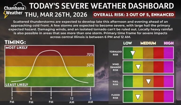
Much of the day today will be warm and breezy but otherwise quiet. Look for scattered storms to develop to our north late this afternoon and evening as a cold front approaches the area. A few strong to severe storms are possible across the area this evening into the first half of the overnight, or between roughly 6:00 p.m. and midnight. Large hail is the primary expected hazard with severe storms locally, but isolated instances of damaging winds and a tornado or two can’t be ruled out. Behind the cold front we turn much colder tomorrow and Saturday, but mild and stormy spring weather returns next week.
Updated Wednesday at 9:30 p.m.
From National Weather Center in Central Illinois: With forecast high temperatures in the mid to upper 80s for Thursday, daily record highs will be falling over most of the region. A level 2 & 3 risk of severe weather remains in place across most of central and southeast Illinois for Thursday. While some of this may occur late in the afternoon near and north of I-74, the best risk of severe weather will be in the evening. With any storms that remain discrete from each other, very large hail and tornadoes will be possible.