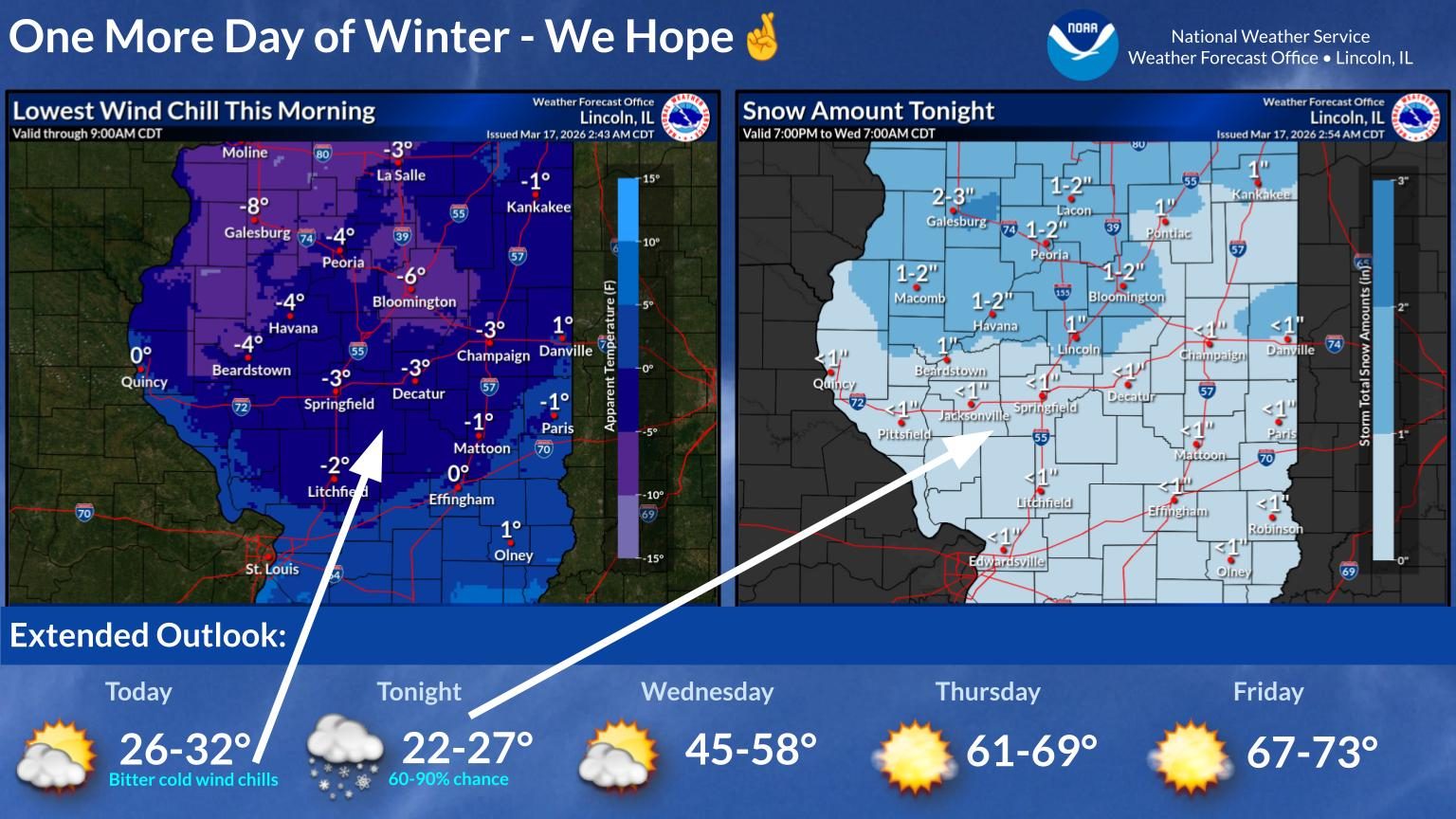
More snow expected tonight warmer temperatures to make comeback near end of the week
Wind chills of 5-10 degrees below zero are expected overnight. Another burst of snow is forecast for Tuesday night.


Wind chills of 5-10 degrees below zero are expected overnight. Another burst of snow is forecast for Tuesday night.
A list of school closing and weather-related announcements for several counties in Central Illinois.
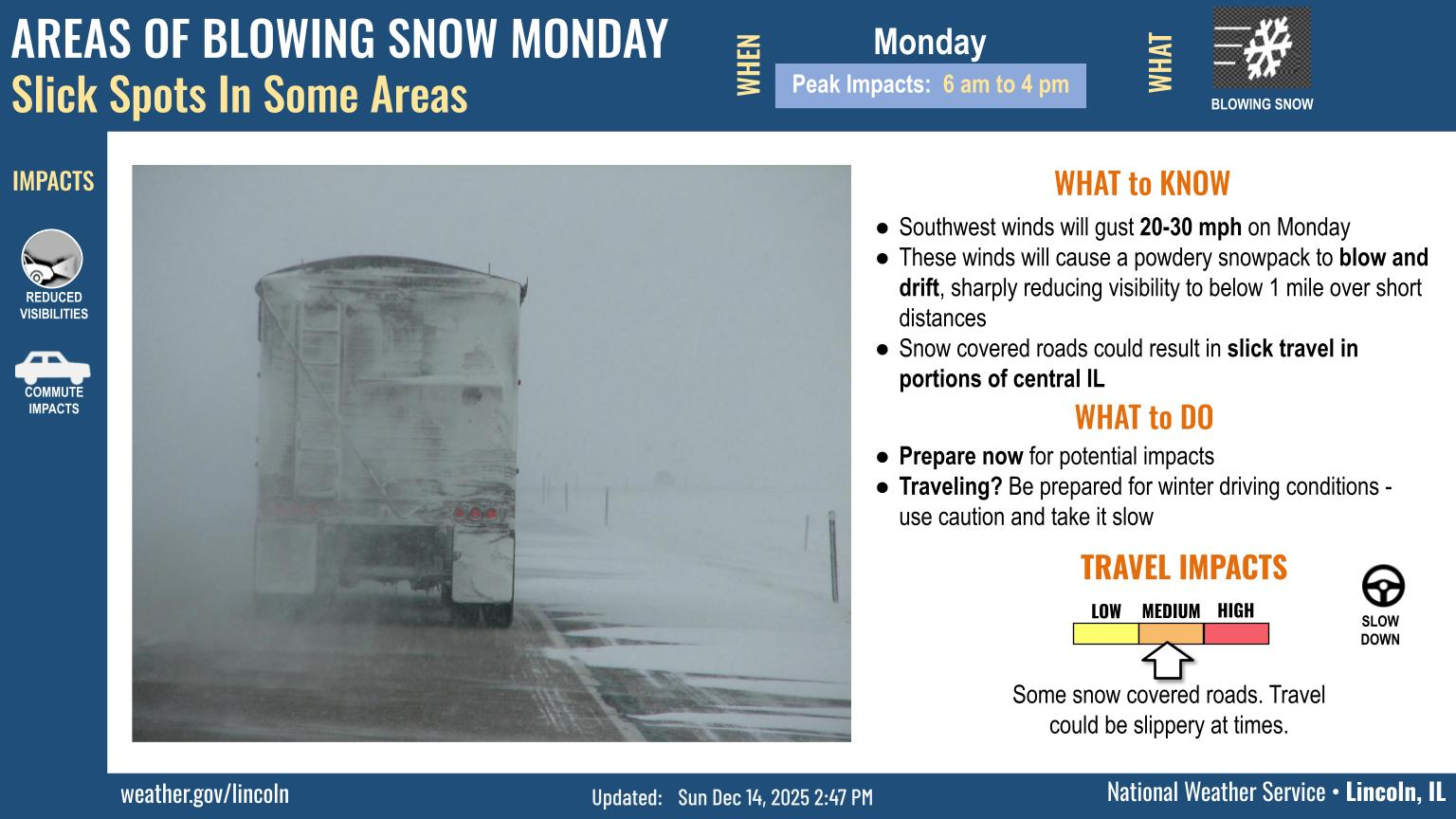
Areas of blowing and drifting snow are possible late tonight into early Monday afternoon.
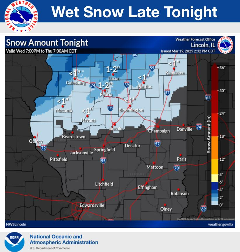
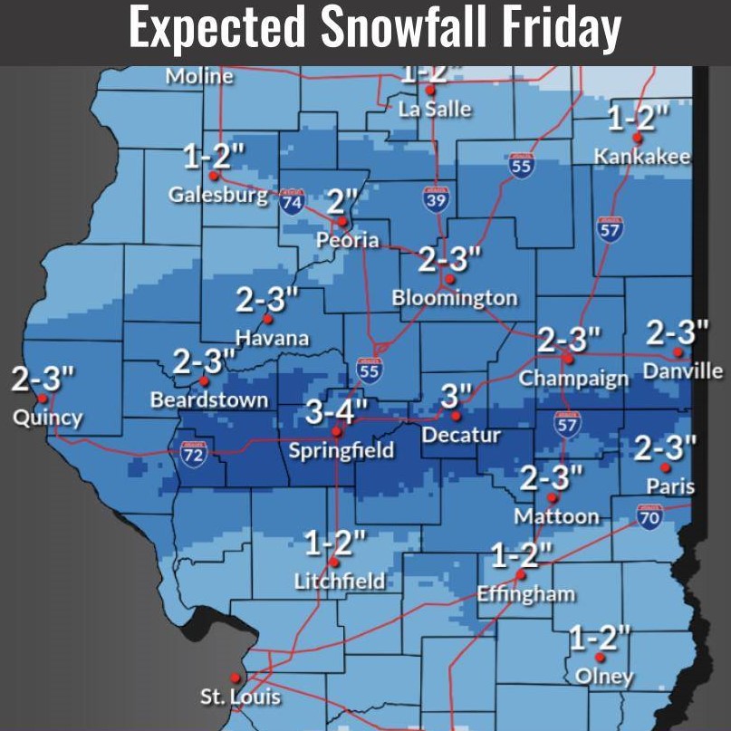
The National Weather Service forecasted 2 to 6 inches of snow north of I-70 in central Illinois.

Gusts of 40-50 mph can be expected through midday, according to the National Weather Service.
From IPM meteorologist Andrew Pritchard: Another, weaker storm system will bring another coating of light, powdery snow to central Illinois on Monday.
Central Illinois could see high wind gusts, low temperatures, and possibly snow this holiday weekend.
There will be a 30-50% chance of at least minor impacts from lake effect snow tonight into Monday morning over portions of Champaign and Vermilion Counties.
Clinton Community School District #15 will be closed Monday due to a power outage.
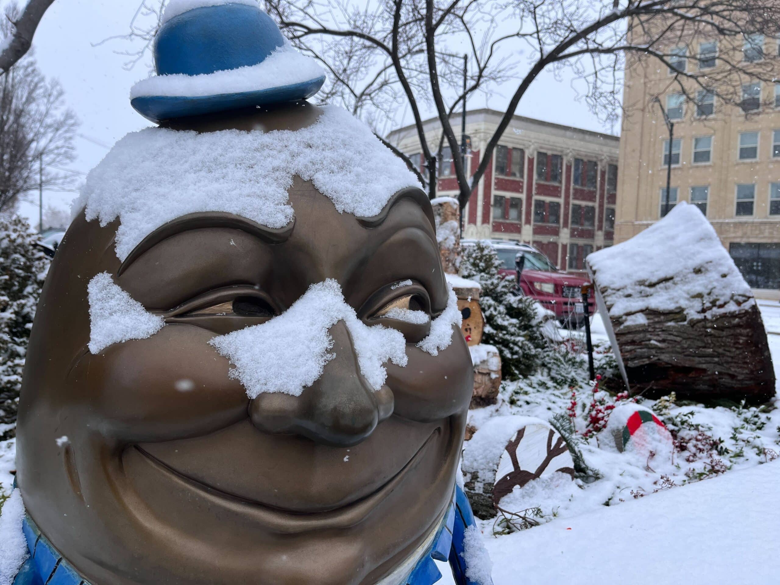
Rain showers this evening will mix with and change to snow overnight.

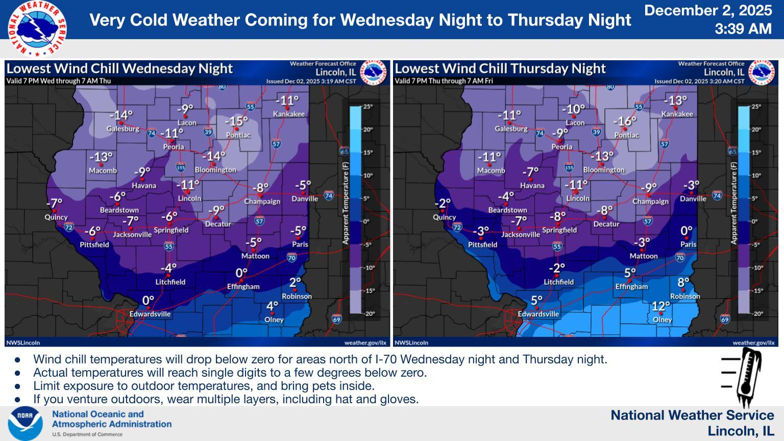
Very cold temps will grip the region this week with night time wind chills well below zero tonight through Thu night.
A Winter Storm Watch has been issued for Champaign County and surrounding portions of East Central Illinois beginning 12 a.m. Sunday through 12 p.m. Monday.
The National Weather Service has issued a wind advisory for Peoria, Champaign, Danville, and several other cities across central and southern Illinois. 1-2 inches of snow is possible as well.
The National Weather Service in Lincoln issued a Winter Weather Advisory for central Illinois, including Champaign-Urbana, Danville and Decatur. Meteorologists are forecasting two to four inches of snow. Click below for the latest from meteorologists. Click here for the latest winter road conditions. Tweets by NWSLincolnIL
“I’m continuing to watch a more significant storm system that’s expected to impact the Midwest during the middle of next week, roughly January 9-10.” – Chambana meteorologist Andrew Pritchard.