
Updated Tuesday, July 28 at 10:40 a.m. CT
Clean-up is underway after damaging winds blew across central and southeast Illinois on Monday.
In Crawford County, the Emergency Manager reported that three 200,000-bushel grain elevators were blown down by winds crushing parked semi-trucks as they came down.
According to the Vermilion County Emergency Manager, a tornado briefly touched down one mile west of Illinois Route 1 in Hoopeston. Damage was limited to a power pole and street sign.
There are no injuries reported at either scene.
Updated Monday, July 27 at 10:45 p.m.
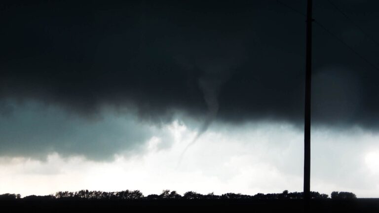
According to the Vermilion County Emergency Manager, a tornado briefly touched down one mile west of IL-1 and about 100 yards south of Thompson Street. A power pole and a street sign were leaning in the immediate vicinity of the tornado.
IPM meteorologist Andrew Pritchard took pictures of the tornado near Hoopeston.
In Crawford County, the Emergency Manager reported that three 200,000 bushel grain elevators were blown down by winds. They crushed a couple of parked semi-trucks as they came down. No one was reported injured.
Updated Monday, July 27 at 6:35 p.m.
IPM meteorologists Ed Kieser and Andrew Pritchard updated listeners on a Tornado Warning in Vermilion County. And Severe Thunderstorm Warning in Edgar County.
Updated Monday, July 27 at 5:50 p.m.
Updated Monday, July 27 at 4:56 p.m.
IPM meteorologist Ed Kieser updated WILL-AM 580 about Tornado Warnings in Kankakee and Iroquois Counties. And storms moving through Champaign County.
Updated Monday, July 27 at 4:38 p.m.
A corridor of storm development will progress southeast across central IL through 6 pm. Remain alert for warnings for your area! #ILwx pic.twitter.com/YfQpwq8FvL
— NWS Lincoln IL (@NWSLincolnIL) July 27, 2026
Updated Monday, July 27 at 3:00 p.m.
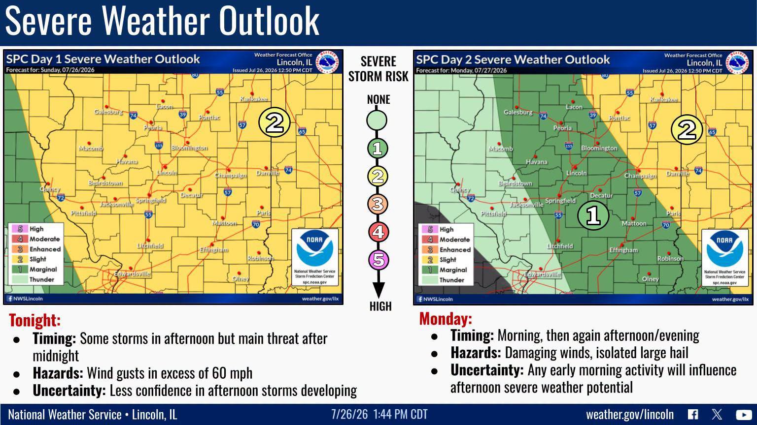
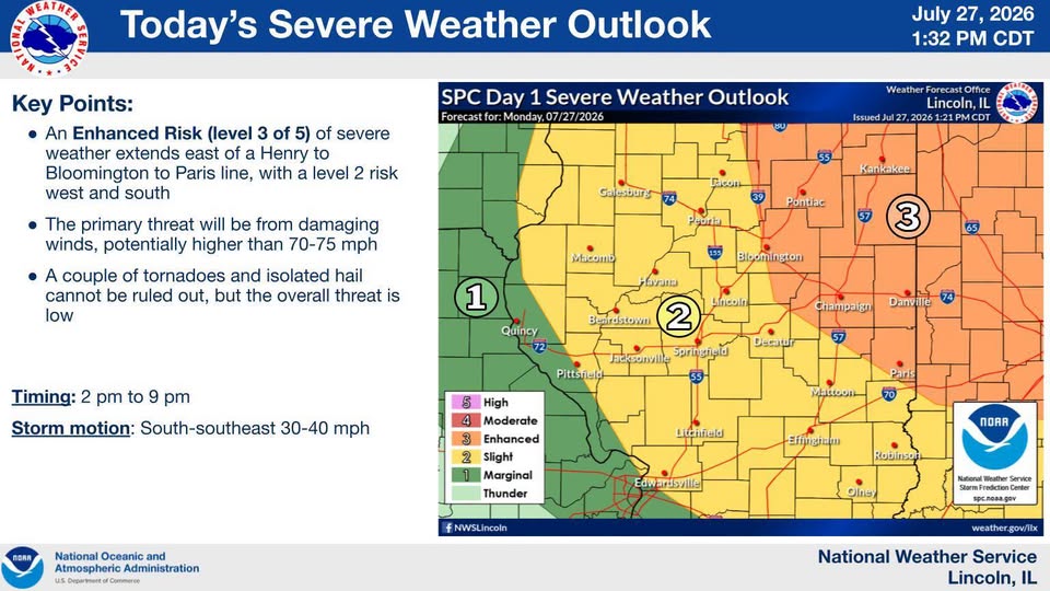
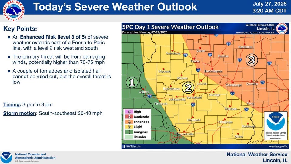
From the National Weather Service in Central Illinois: There remains a fair amount of uncertainty as to the overall evolution of tonight’s severe weather threat, but there is a level 3 risk for areas east of a Henry to Bloomington to Paris line. Damaging winds, potentially above 70-75 mph, are the primary threat with isolated large hail also possible. Timing for the highest threat appears to be in the 2:00-9:00 p.m. time frame moving from north to south. Remain alert for severe weather this afternoon and evening.
Updated Monday, July 27 at 1:56 p.m.
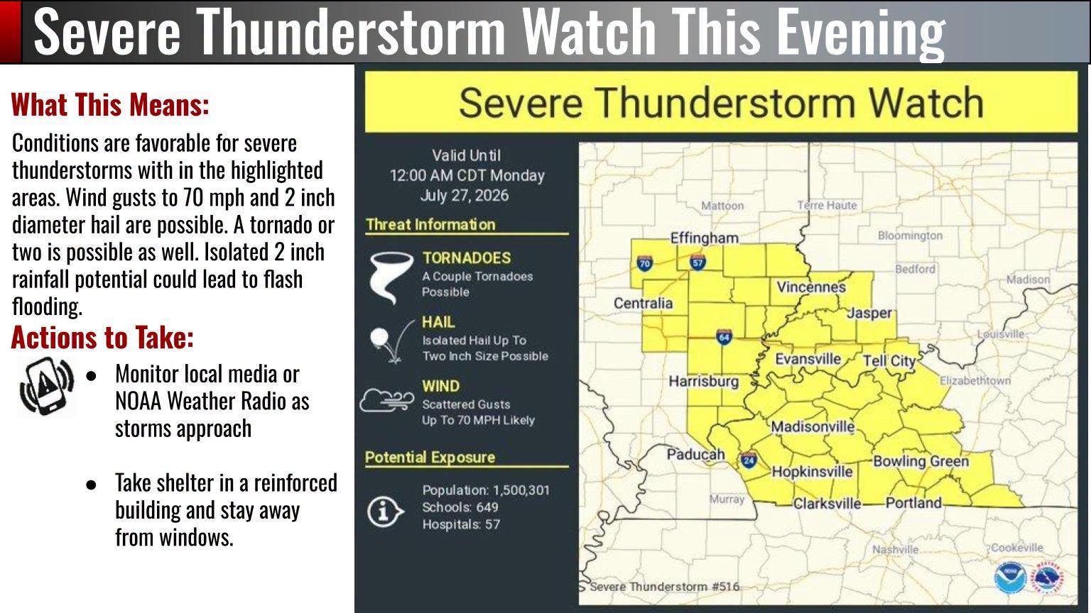
Parts of Central Illinois including Champaign are under Severe Thunderstorm Watch until 9 p.m. Strong winds as well as hail are possible.
A severe thunderstorm watch has been issued for parts of Illinois and Indiana until 9 PM EDT pic.twitter.com/xUXeFyp2AD
— NWS Lincoln IL (@NWSLincolnIL) July 27, 2026
Updated Monday, July 27 at 12:30 p.m.
Updated Monday, July 27 at 7 a.m. CT
From IPM meteorologist Andrew Pritchard:
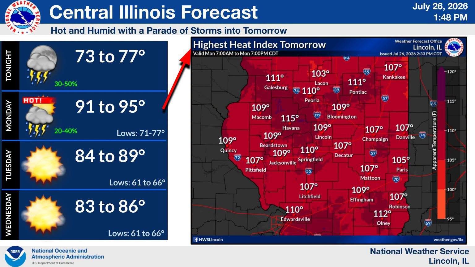
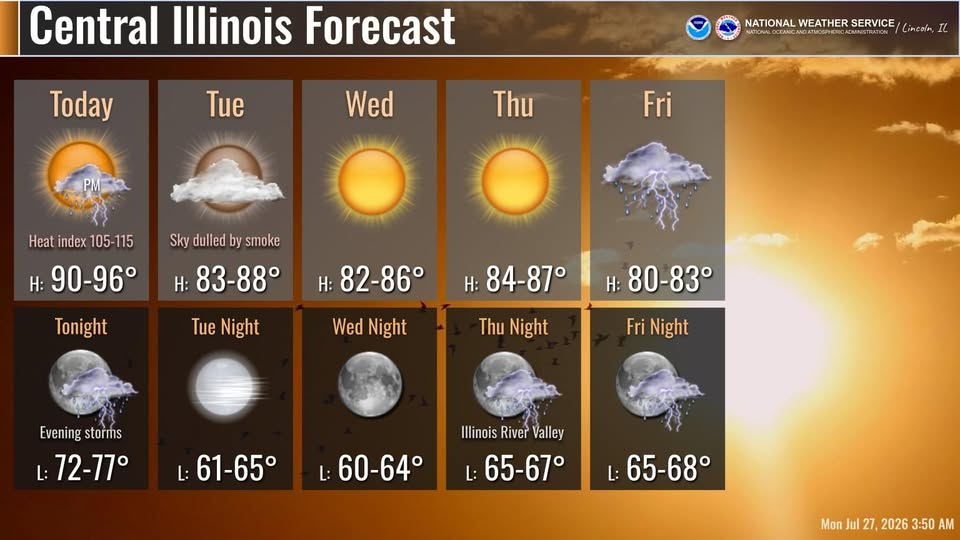
An extreme heat warning is in effect for Champaign County and the surrounding areas of central Illinois through 9:00 p.m. Monday evening. Temperatures are expected to climb into the 90s this afternoon, with high humidity sending heat indices, or what our body actually experiences, into the 110- to 115-degree range. Stay hydrated and when possible, limit strenuous outdoor activity during the peak heating of the afternoon. This heat and humidity will fuel a round of thunderstorms that may push into central Illinois and surrounding areas of the Midwest late Monday afternoon into the evening and overnight hours. The most likely time frame for severe storms in the WILL severe weather coverage area is between 4:00 p.m. and midnight. With damaging wind gusts, the most likely hazard, though an isolated tornado is also possible. Heat, humidity, and severe weather chances will all fade overnight, with sunny, cooler, and less humid conditions on Tuesday.
Updated Sunday at 10:00 p.m.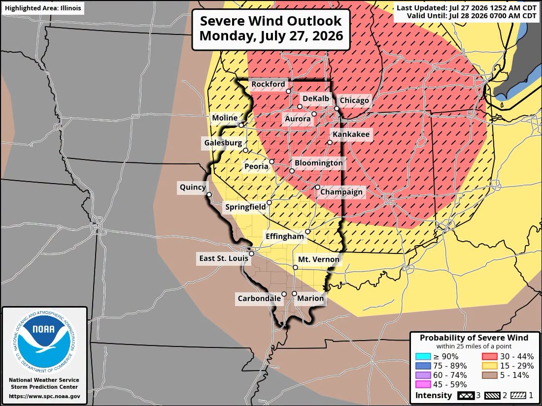
Updated Sunday, July 26 at 10 p.m. CT
CHAMPAIGN – The National Weather Service in Central Illinois is expecting high temperatures in the 90s on Monday. Heat indexes (combined high heat and humidity) are expected to top 110 degrees in Springfield and 107 degrees in Champaign-Urbana, Danville, and Decatur. Highs will cool to the mid 80’s after that. Meteorologists are also concerned about possible storms that could bring damaging winds early Monday morning or Monday evening.