Large hail and tornadoes cause major damage in Illinois on Tuesday
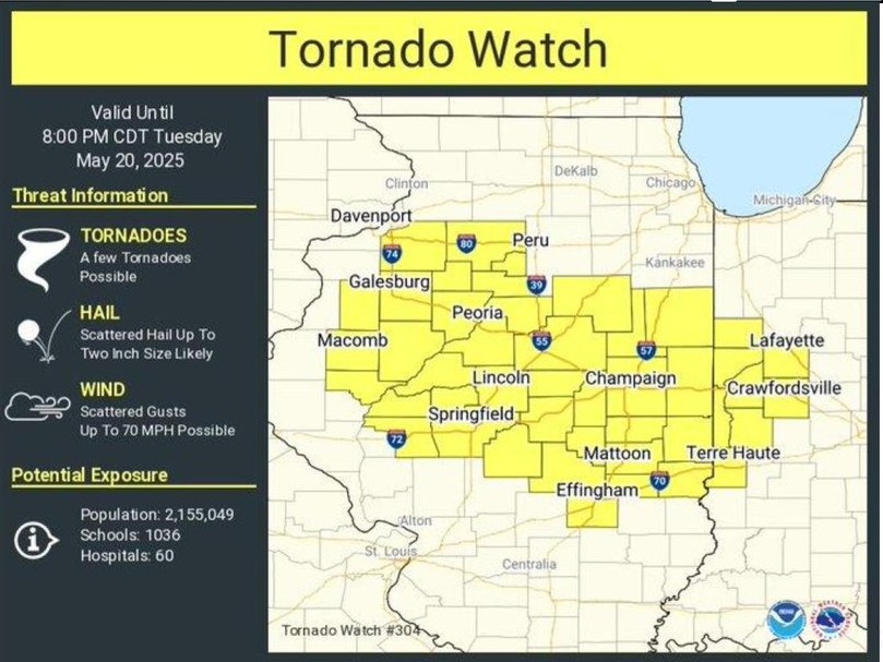
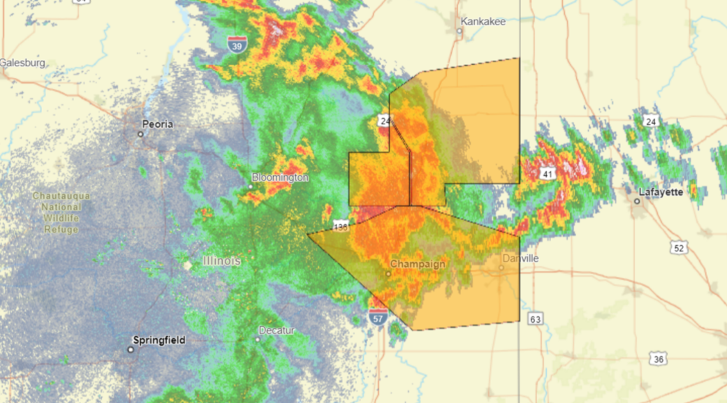
Tornado Watch for Champaign, DeWitt, Logan, Macon, Menard, Piatt, Sangamon and Vermilion Counties until Wednesday at 2am.


Tornado Watch for Champaign, DeWitt, Logan, Macon, Menard, Piatt, Sangamon and Vermilion Counties until Wednesday at 2am.
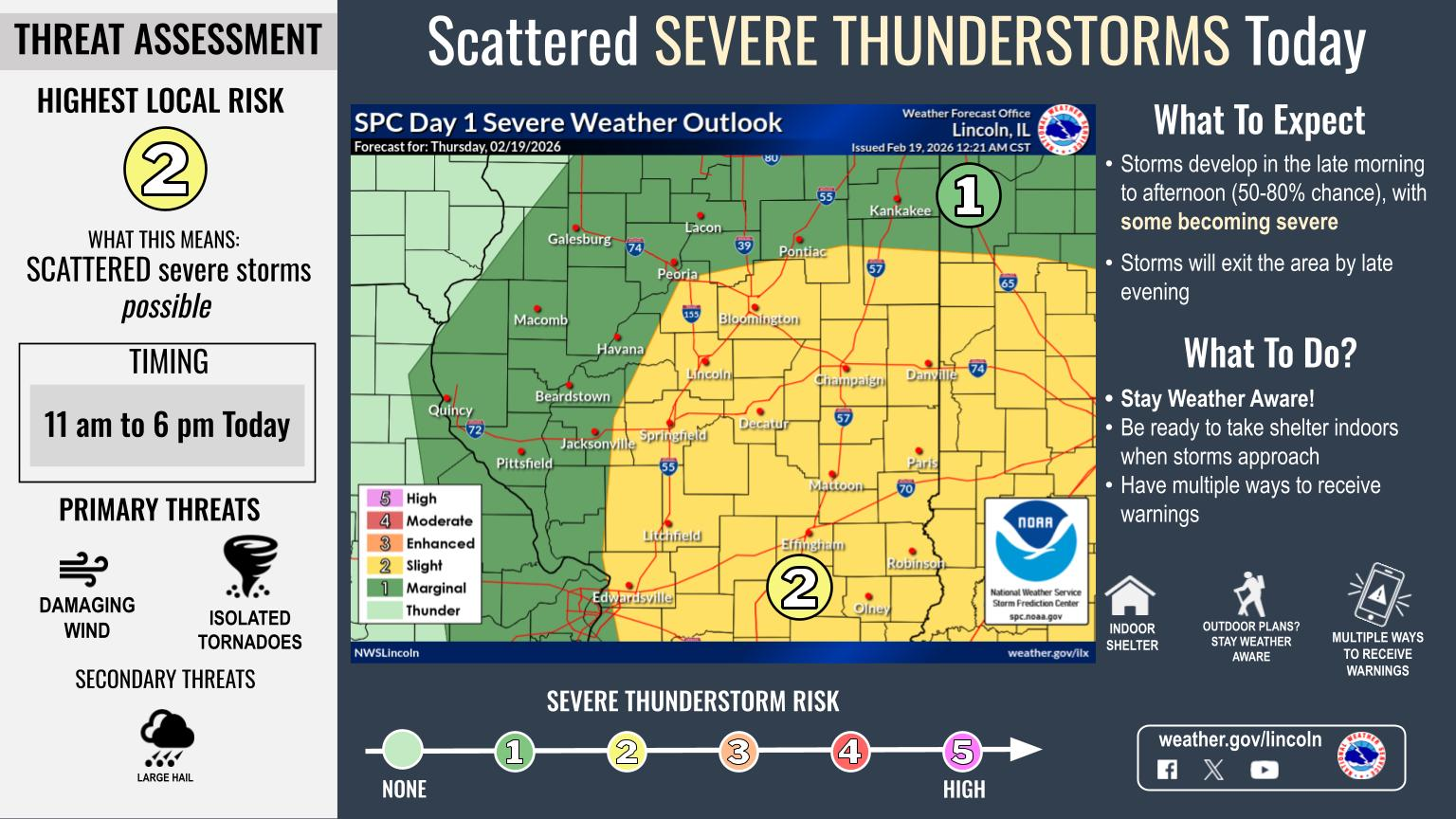
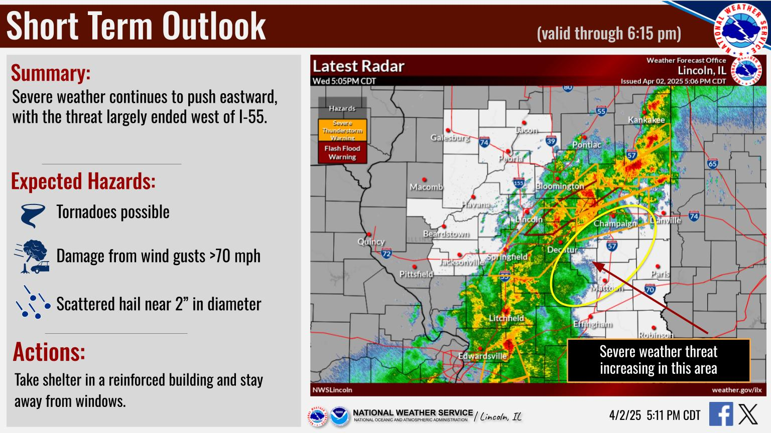
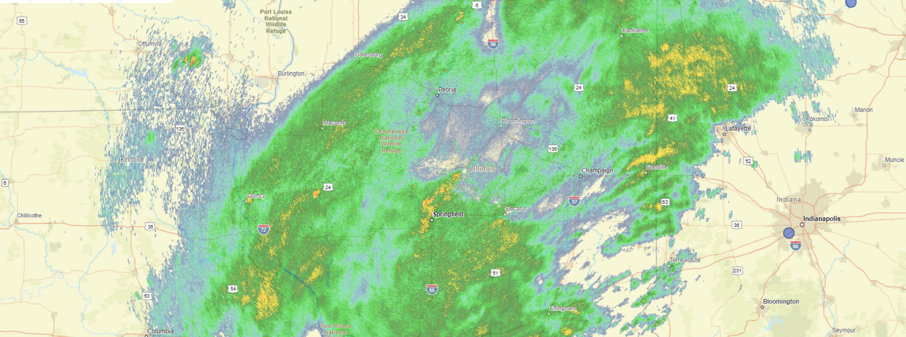
Severe thunderstorms remain on track for today. Locally damaging wind gusts and a few tornadoes are the primary concerns
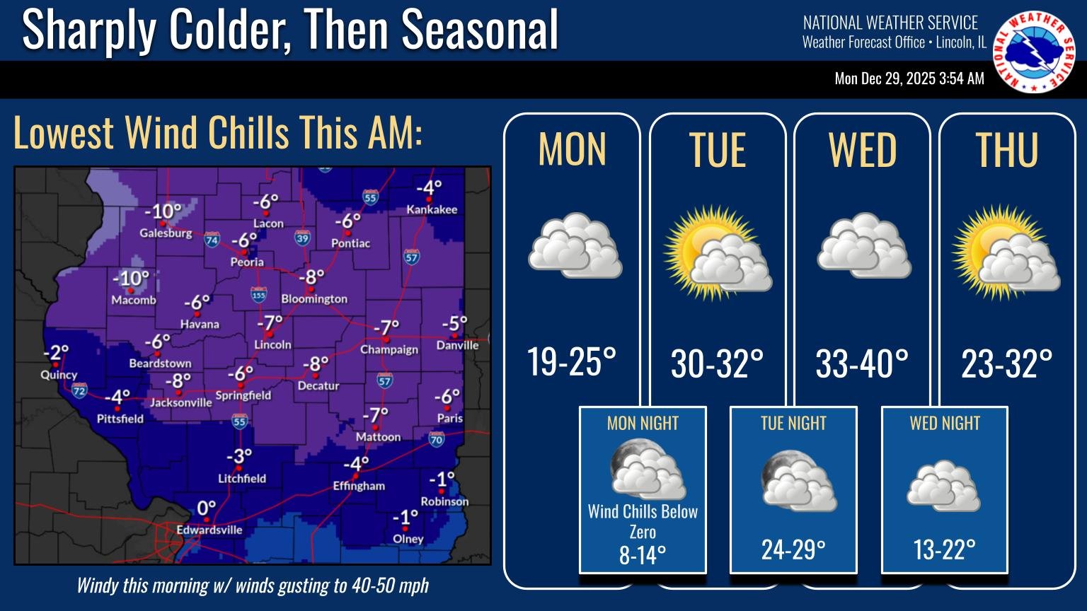
After severe storms and a cold front passed through Central Illinois, the National Weather Service said wind chills are expected to drop below zero again late Monday night and heading into Tuesday morning.
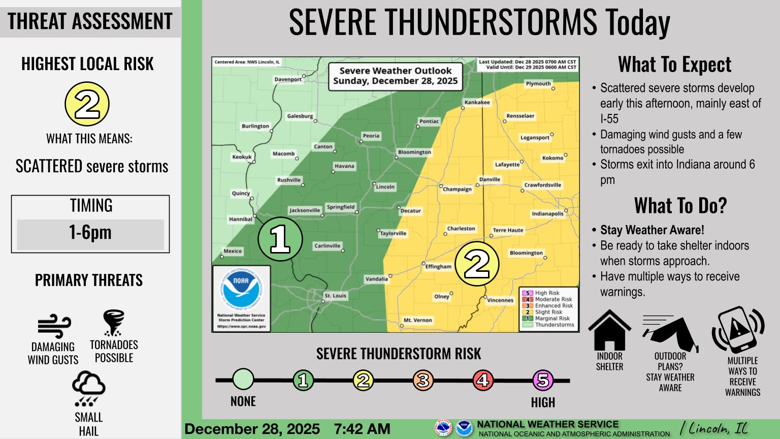
National Weather Service: a strong cold front on Sunday could produce severe storms with isolated damaging winds, isolated tornadoes, and small hail.
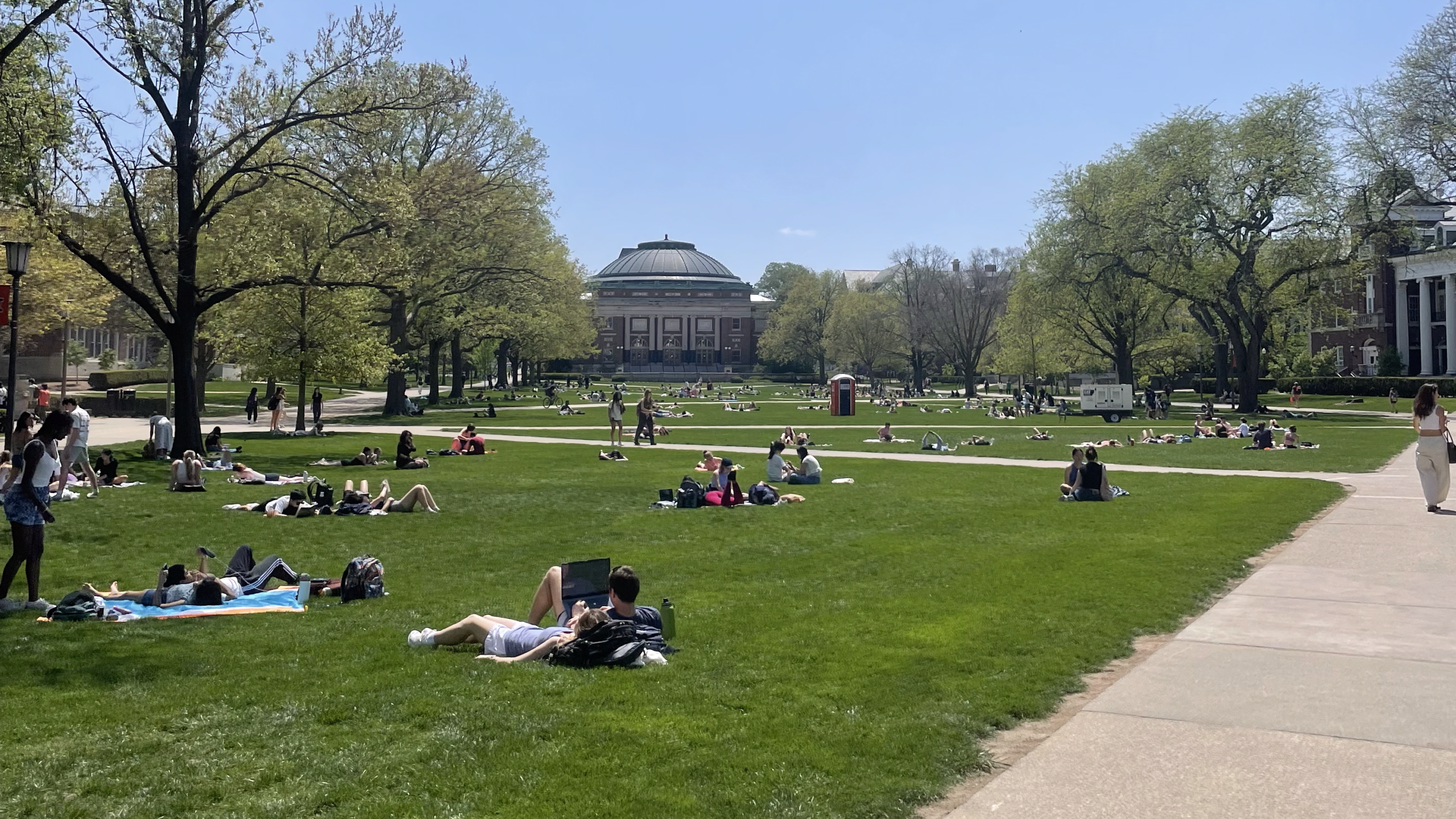
Summer officially kicks off Friday, June 20, and with it, will come higher temperatures and humidity, which can be hazardous to both human health and agricultural ecosystems.
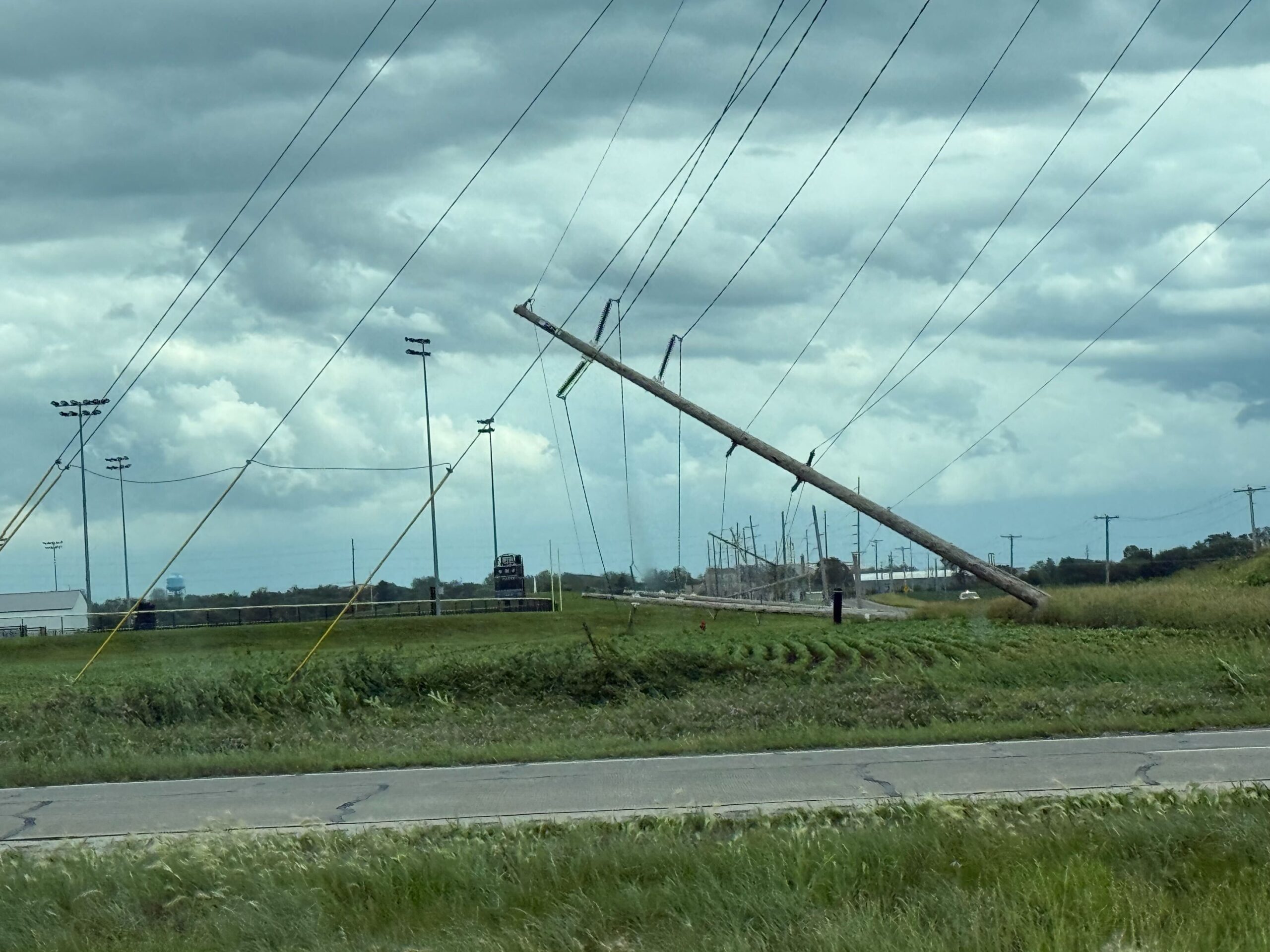
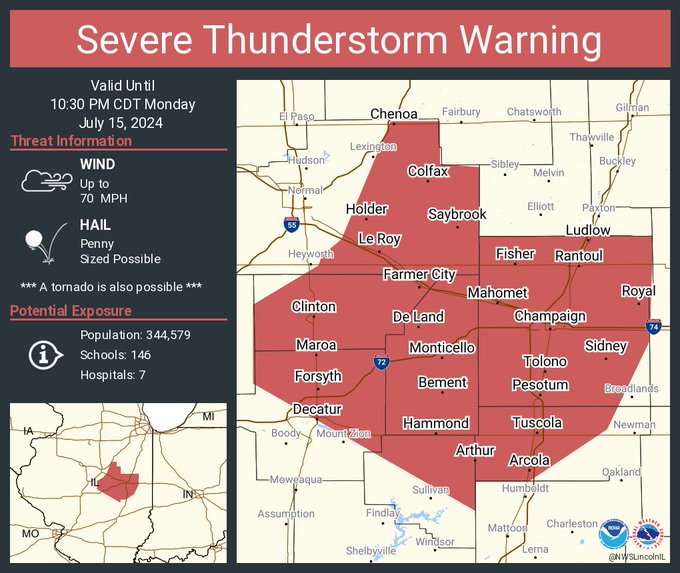
The Tornado Watch expired at 4 p.m., but there were numerous reports of power outages as well as some damage to structures and buildings as well as knocked down trees around Central Illinois.
Expected hazards: Wind gusts over 60 mph, hail 1 to 2 inch diameter, and isolated tornadoes possible.
A flood watch is in effect through Sunday morning for portions of central and east central Illinois, including Shelby, Coles, Douglas, Edgar and Moultrie Counties.
A tornado watch has been issued for parts of Illinois, Indiana, Iowa, Michigan and Wisconsin until 1 AM CDT
Meteorologists in Illinois are closely tracking Hurricane Beryl, as the storm’s remnants are forecasted to sweep through the state from late Tuesday into Wednesday. Beryl touched down in Texas early Monday as a Category 1 hurricane. It was quickly downgraded to a tropical cyclone and shifted northeast towards Illinois. The aftermath of Hurricane Beryl is
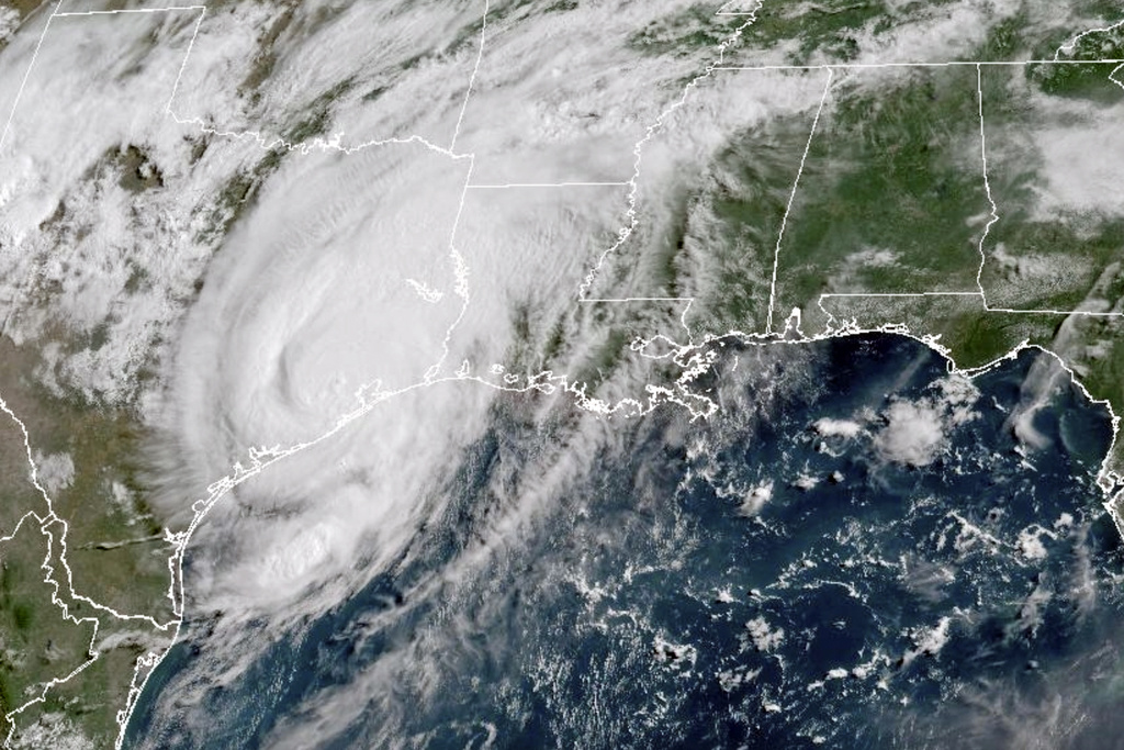
From NWS Lincoln: Tomorrow into Wednesday, the remnants of Hurricane Beryl are forecast to bring a swath of heavy rainfall to some part of central or southeast Illinois. The highest chance (around 20%) for more than 3 inches of rain is south of a Litchfield to Danville line. This would result in localized flooding of poor drainage, urban areas, and could cause some streams and creeks to overflow their banks.
From the National Weather Service in Central Illinois: A line of t’storms will affect the area late Thursday afternoon into the overnight hours. Some severe storms are in the forecast, with damaging wind gusts and large hail. Stay weather aware and be ready to take shelter when storms approach.
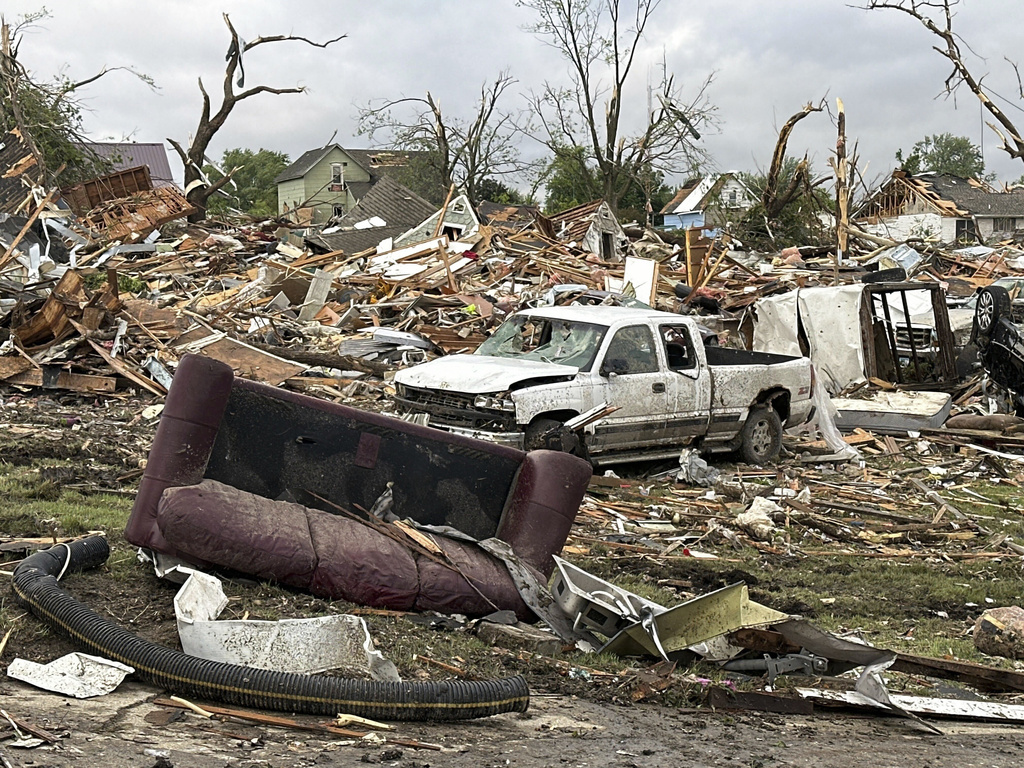
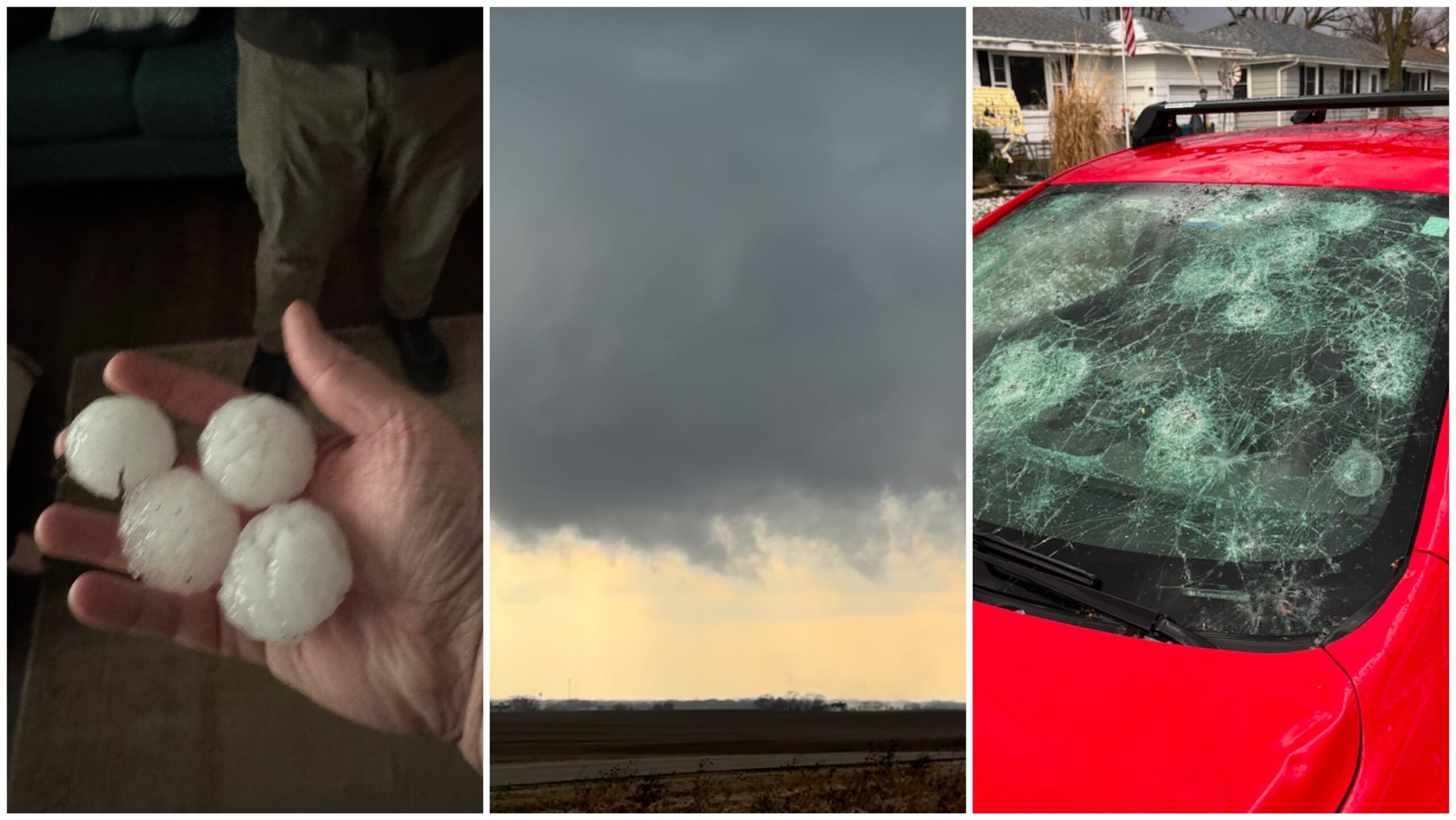
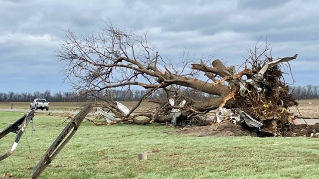
Iowa State Patrol Sgt. Alex Dinkla says at least a dozen people were injured amid widespread devastation in Greenfield. Tuesday saw multiple tornadoes, giant hail and heavy rain in several states.
Farmers can apply for emergency loans after tornadoes and drought last spring.
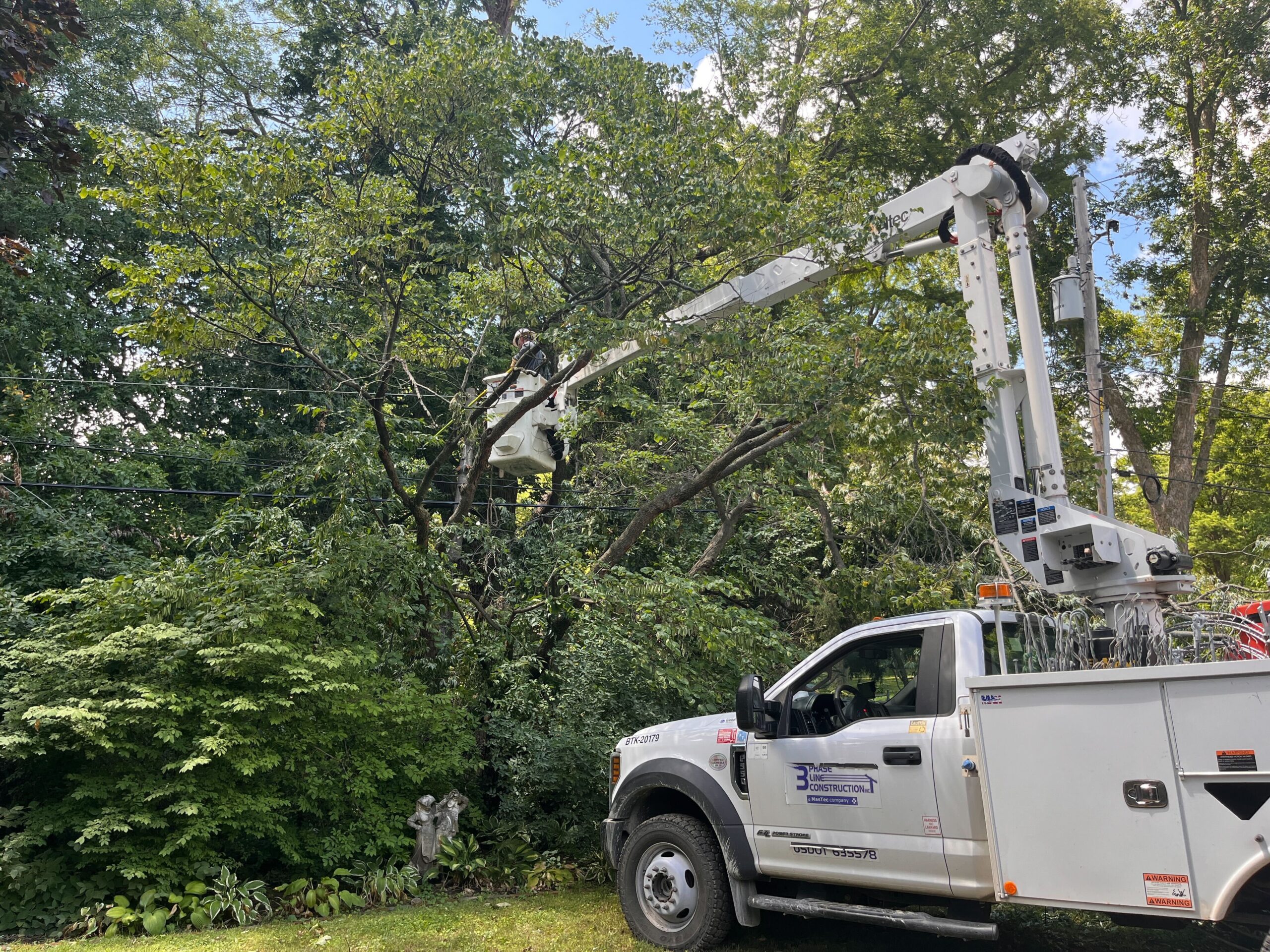
Storms cause damage to Willard Airport in Savoy, flip trailers on interstates and destroy countless trees.