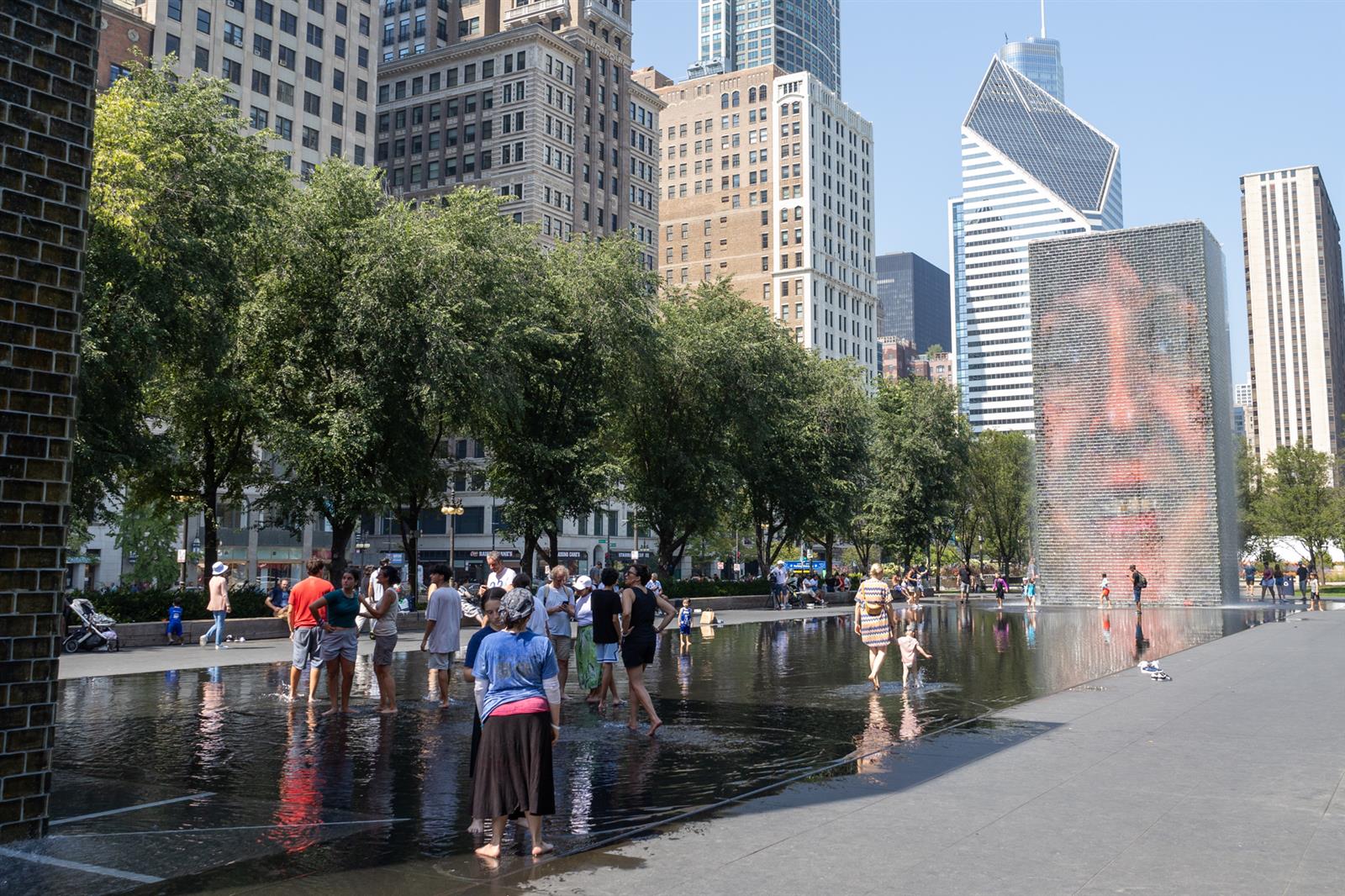
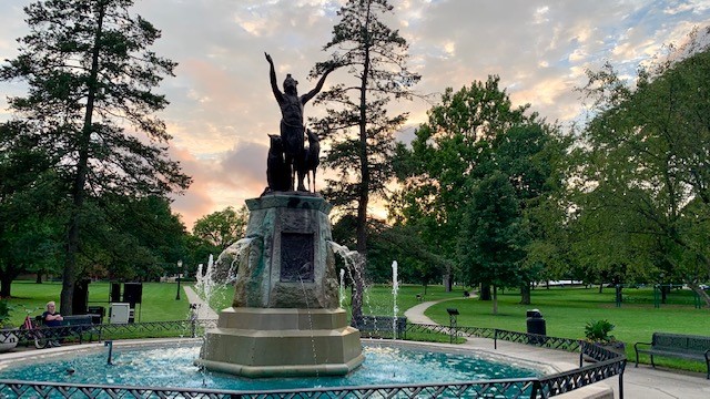
Illinois heat wave is the latest of several weather extremes in the state
Dangerously high heat follows drought conditions earlier this summer.


Dangerously high heat follows drought conditions earlier this summer.
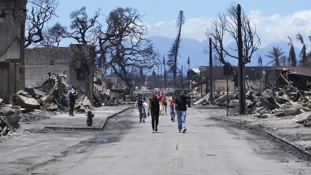
The wildfires are the state’s deadliest natural disaster in decades, surpassing a 1961 tsunami that killed at least 80 people. Many survivors of the fire said in interviews they did not receive a warning that gave them enough time to flee.
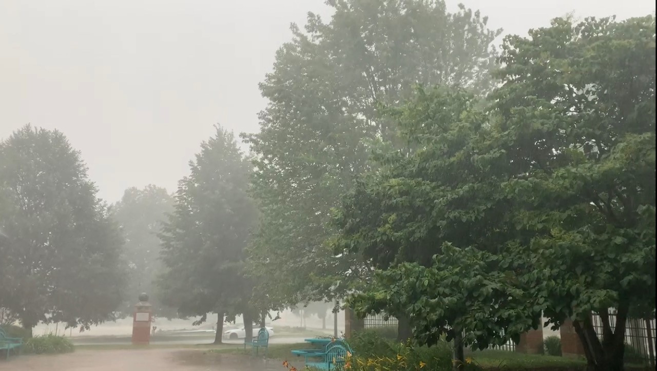
The National Weather Service says periods of showers and thunderstorms are expected through the weekend. Highest chances will be Friday morning, and again Sunday evening.
The National Weather Service in Central Illinois is forecasting thunderstorms, some severe, late Friday into Saturday morning. Check here for the latest forecast and weather information. A special weather statement has been issued for Rantoul IL, Thomasboro IL and Gifford IL until 1:00 AM CDT pic.twitter.com/RGzXfLhe8Z — NWS Lincoln IL (@NWSLincolnIL) July 29, 2023 Sirens
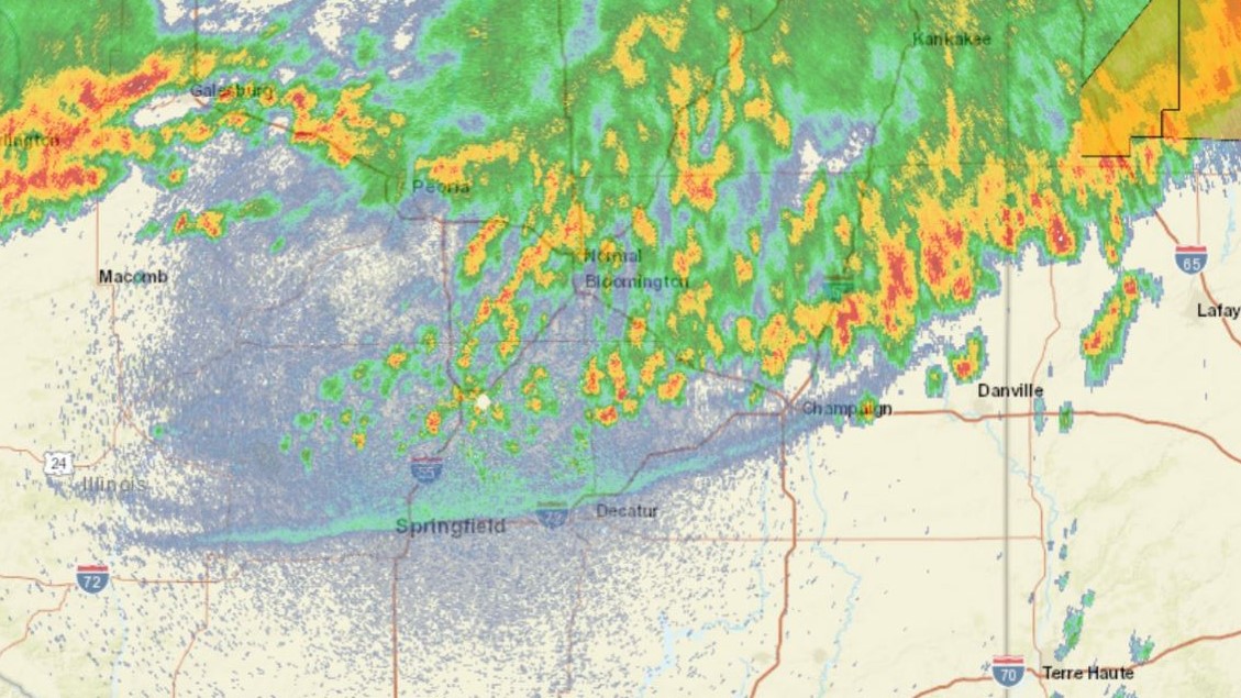
The National Weather Service in Central Illinois is forecasting Heat Index values higher than 100 degrees this week. Check here for the latest forecast and cooling center information. Less humid air starts to push in on Saturday, but will take until Sunday to fully cover the area. The best chances for rain in the near
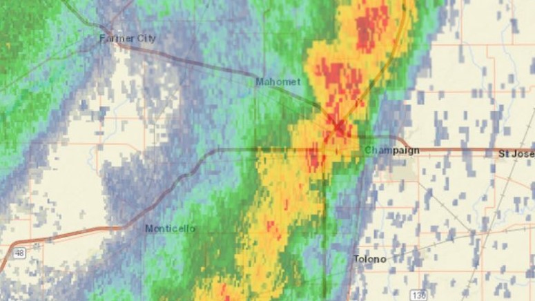
The National Weather Service in Lincoln says thunderstorms are possible in Central Illinois on Thursday afternoon. [2:57 PM] The storms in Vermilion and Edgar Counties have moved into Indiana, but much of Clark County is being affected by another storm which could produce some gusty winds and small hail as it drifts slowly towards the
This AP interactive map shows forecast air quality across the United States, including areas affected by Canadian wildfires. This interactive map will update daily.
The National Weather Service in Lincoln says thunderstorms are possible in Central Illinois on Monday afternoon. A severe thunderstorm watch has been issued for parts of Illinois and Indiana until 12 AM EDT pic.twitter.com/jXUYDOFKRf — NWS Lincoln IL (@NWSLincolnIL) July 17, 2023 A special weather statement has been issued for Taylorville IL, Assumption IL and
The National Weather Service in Lincoln says thunderstorms are possible in Central Illinois after midday on Wednesday. A chance (20-40%) for scattered showers and thunderstorms exists this evening as a cold front slowly moves into the region. A few storms along and south of I-72/Danville may produce damaging wind gusts and hail. Storms may then
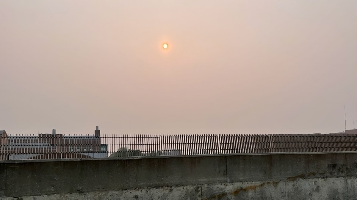
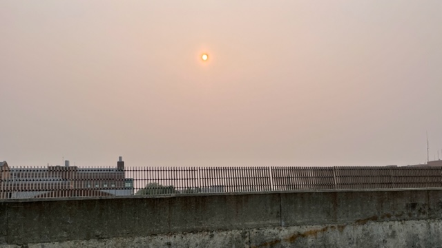
Canadian wildfire smoke is not only impacting your health but the economy, says a new study.
Farmers can apply for emergency loans after tornadoes and drought last spring.
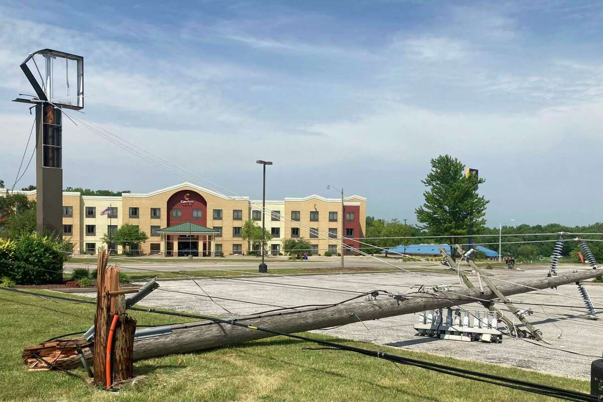
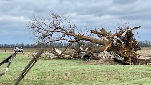
Observers said the devastation easily matched that of other Springfield-area weather disasters of memory, including a March 2006 tornado and a March 1978 ice storm. The severe weather phenomenon kicked up straight-line winds topping 70 mph and drove rain horizontally.
Storms cause damage to Willard Airport in Savoy, flip trailers on interstates and destroy countless trees.
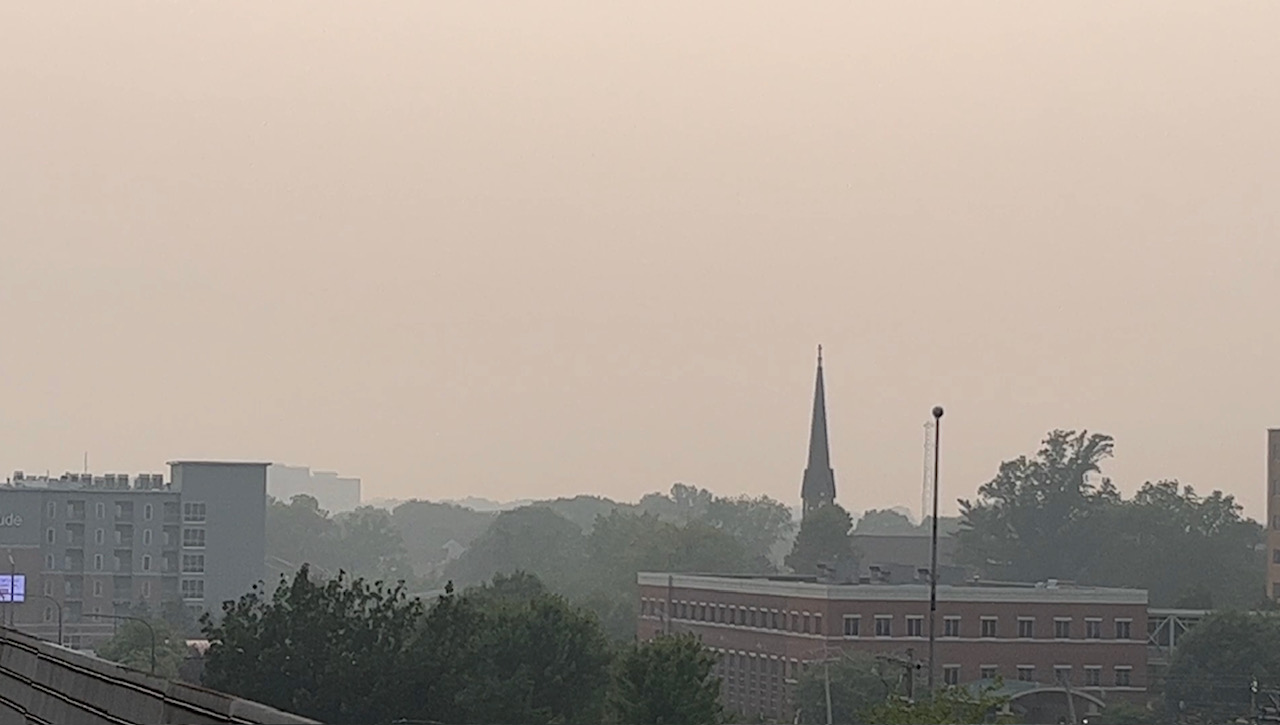
Neither the 235 out-of-control Canadian wildfires nor the stuck weather pattern that’s responsible for this mess of meteorological maladies are stubbornly showing no signs of relenting for the next week or longer.
Illinois Public Media News is monitoring severe storms forecasted for Central Illinois on April 4. This post will be updated with information from the National Weather Service in Lincoln and Chambana Weather meteorologist Andrew Pritchard. According to Chambana Weather meteorologist Andrew Pritchard, the severe weather risk will remain northwest of Champaign Urbana on Tuesday, focused around the Quad