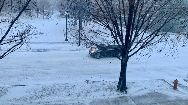
URBANA – A daylong winter storm brought rain, freezing rain, sleet, and snow to Central Illinois on Thursday. Meteorologist Andrew Pritchard talked with Illinois Newsroom’s Reginald Hardwick about when the winter storm will leave the Champaign-Urbana area and the weekend warm-up.
Snow is winding down across central Illinois late this evening. Bitterly cold temperatures will set in overnight with lows dipping into the single digits and a few spots falling below zero. Expect dry weather through the weekend with warmer temperatures back by Sunday. #ilwx pic.twitter.com/tlFzm6bku9
— NWS Lincoln IL (@NWSLincolnIL) February 18, 2022
Hardwick: What will travel conditions be like tonight?
Pritchard: We’re expecting the evening commute to be pretty rough, especially I’ve heard really slow going on the interstates, some of the rural roads, the state highways out there really slow as well. And as I look at some of the roads across Champaign Urbana inside the metro, those are all becoming snow-covered as well. So I think you’ll still be able to get around town, I know we’re only getting a few inches of snow here, the winds are going to exacerbate that as well. Road crews are out there and they’re working on it. So you know it’s not going to be impossible. We want to make sure that we limit [travel] this evening because it is going to be rather treacherous out there. Even though we’re only getting a few inches of snow.
Hardwick: Let’s focus on 7pm to midnight, is that when you expect the snow to move out?
Pritchard: That seven o’clock to midnight timeframe: that is when the storm will start to pull away from us in central Illinois. So between that time we’ll see the snow taper off and come to an end, we’ll see those winds begin to taper off as well after sunset still gusty at times over 20 to 30 miles per hour. But they’ll fade quickly during that 7 pm to midnight frame as well. So that’s when conditions will begin to rapidly improve as we head into the overnight and then road. Road crews can really begin in earnest to actually clear the snow from the roads as we head to the rest of the night.
Hardwick: What kind of roads can we expect when we get up in the morning to go to school or work?
Pritchard: I think most people will be able to get where they need to be on Friday morning if you can leave a little extra time. If you don’t have to leave on Friday morning, maybe that’s even better. I do think the road crews will have a chance to get most of the primary roads, you know drivable and then a lot of the secondary roads drivable as well still going to be some snow and ice on the roads across Champaign Urbana but with much of the overnight free for the roads to be cleared. I think that we’ll be able to drive from point A to point B. In the open areas interstates rural highways, those may be a little bit slower going with the winds, you know, staying it not as strong but still on the the gusty side through the first part of the night. Maybe still some visibility issues and some issues getting the roads clear there. And the open areas but you know, leave some extra time, but it’s not going to be like it was two weeks ago. I do think folks will be able to resume normal activities as we get into Friday morning.
Hardwick: Andrew, what should we expect during the day tomorrow and the weekend?
Pritchard: Well, the good news is once the storm pulls away during the overnight it will be leaving us quickly and conditions rapidly improve. We’re expecting sunny skies for the day on Friday. It’s going to be cold out there. High temperature in the upper 20s. dropping back into the teens on Friday night with another sunny and chilly Saturday. We warm up rapidly for the back half of the weekend. The high of 23 on Saturday, with a high temperature of 46 on Sunday with sunny and breezy conditions. Yeah, the snow will be around for a couple days this weekend. But as we get into Sunday, we’re going to start rapidly melting that snow back into the 40s and 50s as we head into early next week.

