

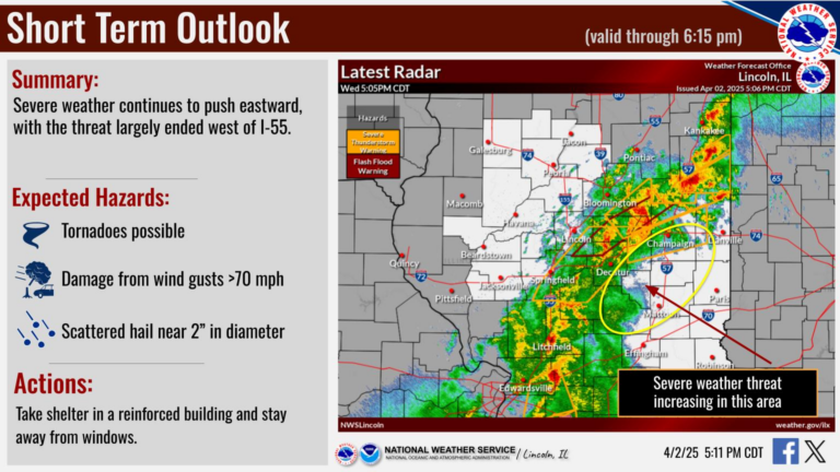
Scattered severe storms are likely today for central and southeast Illinois, according to the National Weather Service. Damaging wind gusts, large hail, and tornadoes are all possible during this period. Very large hail, widespread damaging wind, and a few strong tornadoes are favored near and south of I-70.
A tornado watch is in effect until 10pm for the following counties: Champaign, Coles, De Witt, Douglas, Ford, Macon, Moultrie, Piatt and Vermilion Counties.
A flood watch is in effect through Sunday morning for portions of central and east central Illinois, including Shelby, Coles, Douglas, Edgar and Moultrie Counties.
Up to five inches of rainfall is likely through Sunday morning and significant river flooding may develop during this period, the National Weather Service reports.
Outside of thunderstorms, south winds will gust 45-55 mph today. This will cause difficult travel for high profile vehicles and could cause scattered tree and power line damage.