

Updated Tuesday March 17, 2026 at 2:35 p.m.
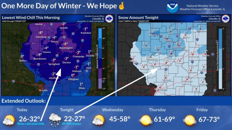
Snow is expected Tuesday night, but temperature will steadily get warmer with a possibility of 70 degrees on Friday.
Another burst of snow is forecast for tonight. The pot o' gold at the end of the forecast rainbow? Much warmer weather returns later this week, with highs in the 60s by Thursday and some 70s on Friday. #ILwx pic.twitter.com/pNjAYamDTk
— NWS Lincoln IL (@NWSLincolnIL) March 17, 2026
Updated Tuesday, March 17 at 8:15 a.m.
From meteorologist Andrew Pritchard:
High winds and powdery snow made for treacherous travel conditions across portions of northern and central Illinois on Monday, with interstate closures becoming commonplace due to multiple accidents from snow and ice-covered roadways. Highways and interstates between Champaign and Chicago and across surrounding portions of northern and central Illinois remain mostly snow and ice-covered early Tuesday morning from gusty winds overnight.
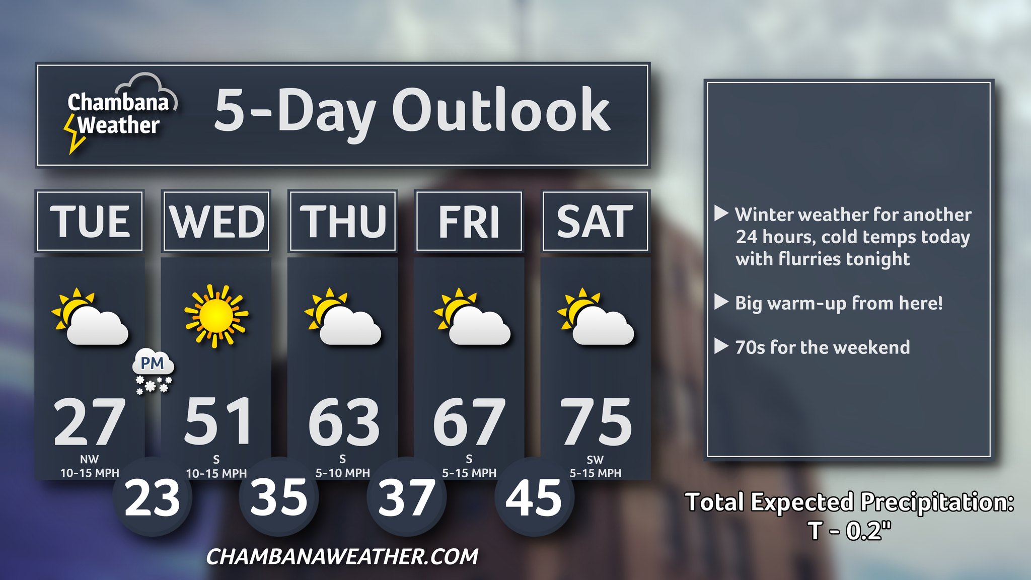
Some improvement is expected today as winds begin to relax, allowing road salt and snow removal efforts to catch up. A little light snow is possible again tonight, but mild spring weather returns on Wednesday with a big warm-up headed into the weekend.
Updated Monday, March 16 at 11:00 p.m.
Roadways around central Illinois remained snowpacked and closed due to hazardous conditions on Monday night. At times, I-57 between Chicagoland and Champaign-Urbana was closed for hours on Monday because of numerous crashes.
The National Weather Service in Central Illinois expects blowing snow will diminish as winds subside Monday night into Tuesday morning. Wind chills of 5-10 degrees below zero are expected overnight. Another burst of snow is forecast for Tuesday night. However, much warmer weather is returning. IPM meteorologist Andrew Pritchard is forecasting 70 degrees by Friday!

Updated Monday, March 16 at 3:00 a.m.
From Sunday evening through Monday morning, Champaign County and the surrounding areas experienced severe weather warnings, a sharp drop in temperatures, snow, and high winds. The weather headlines:
- Sunday at 6:44 p.m., the National Weather Service in Central Illinois issued a Tornado Warning for Champaign, Douglas, Moultrie, and Piatt Counties. Sunday at 7:12 p.m., another Tornado Warning was issued for Champaign, Douglas, and Vermilion Counties.
- Champaign County Emergency Management reported that a tree fell on a home in Tolono.
- In Douglas County, a possible tornado blew the roof off a barn in Arthur and carried several tree tops a few hundred feet. Downed tree branches were reported in other parts of the village.
- Until Monday at 10:00 a.m., a High Wind Warning is in effect for Champaign, Coles, DeWitt, Douglas, Macon, Moultrie, Piatt, Sangamon, and Vermilion Counties and surrounding areas. Meteorologists are expecting south winds 25 to 35 miles per hour with gusts up to 45 to 55 miles per hour. Overnight, the winds will switch directions to west-northwest.
- As of Sunday at 10:00 p.m., rain was switching to snowfall.