

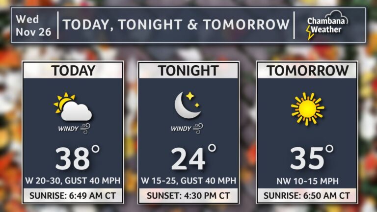
A wind advisory is in effect as high winds and arctic air make their way through Central Illinois.
The National Weather Service’s advisory is in effect for portions of central, east central, southeast, and west central Illinois until 6 pm Wednesday. Westerly winds gusting to 40 miles per hour are expected. Overnight lows will fall into the teens, with highs in the 30s through the holiday weekend.
Unsecured objects could be blown around, limbs could be blown down, and a few power outages may result grom the strong winds, according to NWS. Additionally, winds this strong could make driving difficult, especially for high profile vehicles and drivers are advised to use extra caution.
West-northwest winds will gust up to 40-50 mph today, creating difficult travel for high profile vehicles. Use extra caution when driving and be sure to secure any loose outdoor objects, including holiday decor. #ILwx pic.twitter.com/xyhQC6hny5
— NWS Lincoln IL (@NWSLincolnIL) November 26, 2025
There remains some potential for accumulating snow across East Central Illinois, but the odds of significant snowfall remain highest in the north, including the Chicago Metro and portions of Northern Illinois, according to meteorologist Andrew Pritchard.
A winter storm will bring accumulating snow to parts of central Illinois late Friday night-Saturday. There is still some uncertainty on where rain mixes with snow, which will ultimately drive precipitation amounts and the magnitude of impacts. Check back for updates. #ILwx pic.twitter.com/GvVIl375aK
— NWS Lincoln IL (@NWSLincolnIL) November 26, 2025