

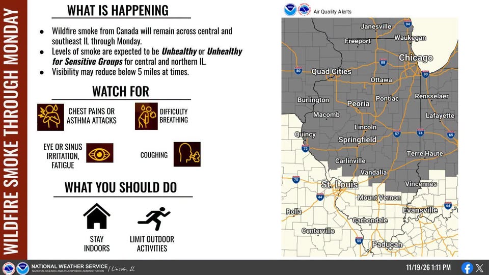
Dangerous air continues in central Illinois on Monday, strong to severe storms tonight
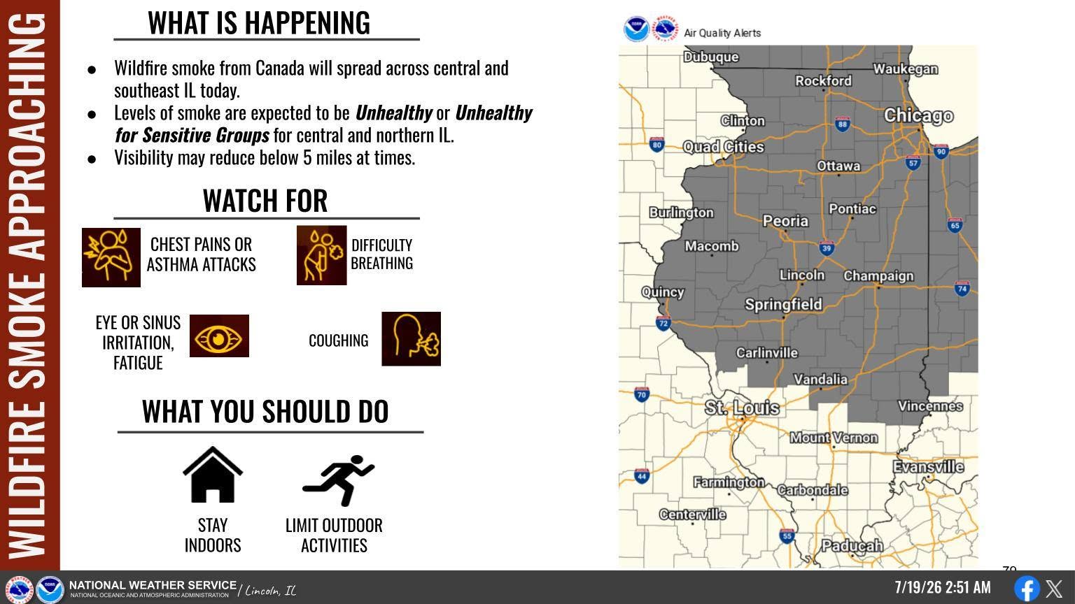
CHAMPAIGN – The National Weather Service in Central Illinois said levels of smoke from Canadian wildfires made the air unhealthy in central, northern and southeast Illinois on Sunday and Monday. Strong to severe storms will move the air out late Monday night.
Monday’s forecast from IPM meteorologist Andrew Pritchard:
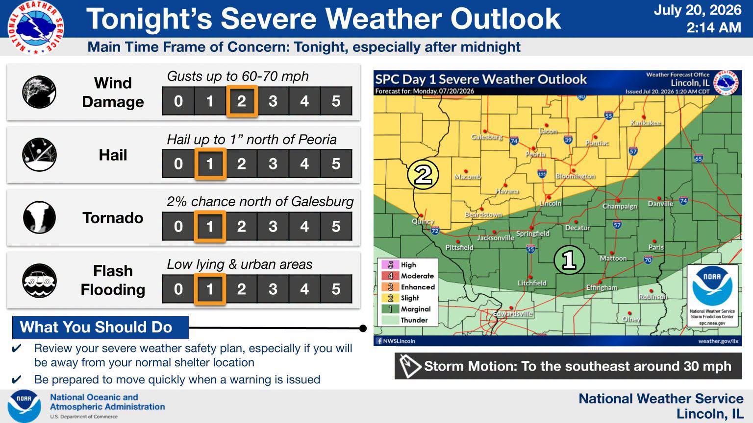
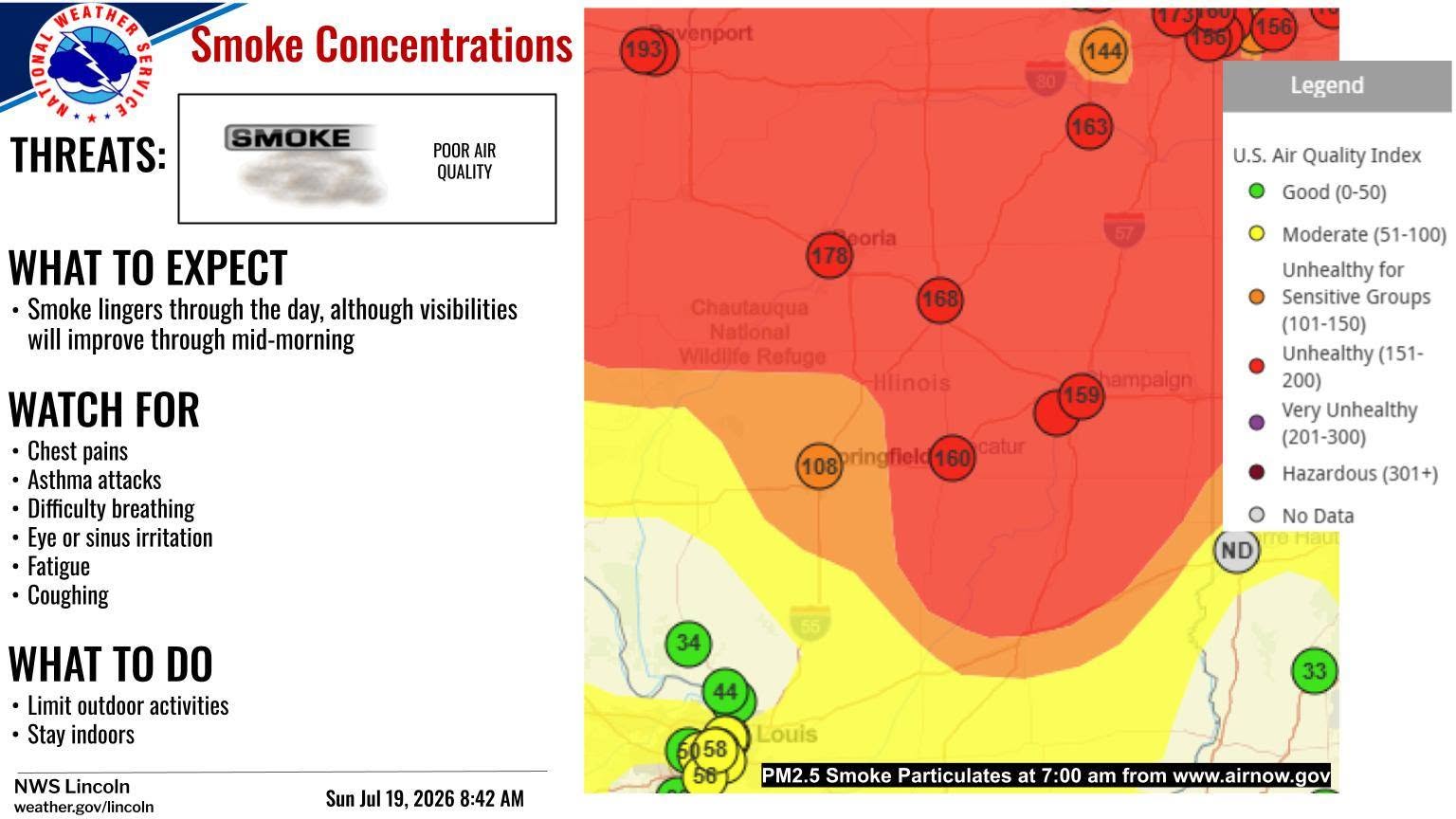
Air quality is still at unhealthy levels in many corners of central Illinois on Monday morning due to a dense plume of wildfire smoke hovering over the region. Smoke will clear from west to east across the area through the day today as a storm system approaches from the west, pushing the smoke away from the area. The same storm system brings a risk of severe weather to the Midwest today with storms erupting over portions of Iowa, Wisconsin, and Northern Illinois this afternoon and evening. A cluster of strong to severe storms may organize and push into Central Illinois late Monday night with damaging wind gusts, locally heavy rainfall, and a tornado or two possible.
On Monday, people are advised to limit outdoor activities. And if you are sensitive to poor air quality or experience symptoms such as chest pains, asthma attacks, difficulty breathing, eye or sinus irritation, fatigue, or coughing, you’re advised to stay indoors.
The conditions forced the Crystal Lake Park Family Aquatic Center and The Lake House In Crystal Lake Park to close early on Sunday afternoon.
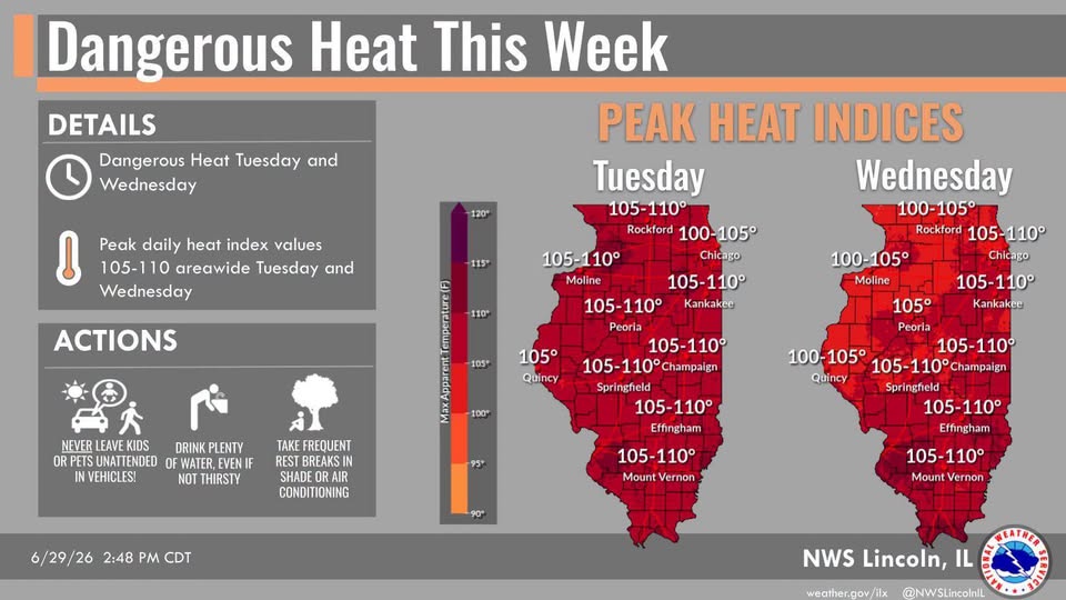
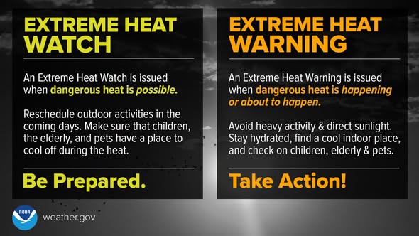
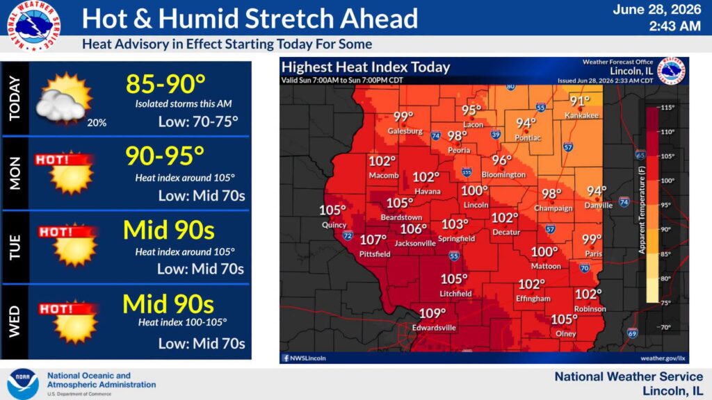
Extreme Heat Warning issued for Illinois
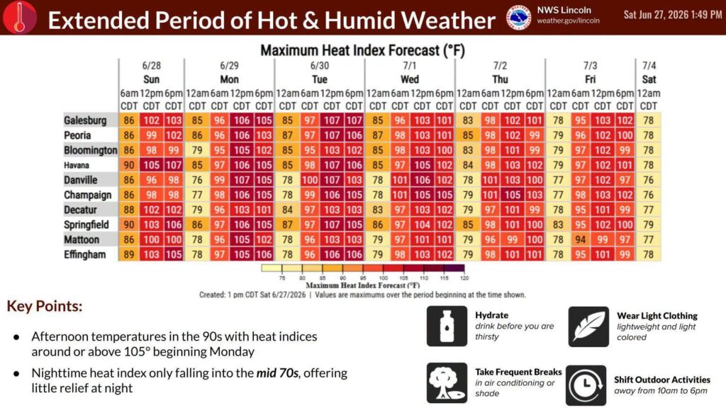
The National Weather Service has issued an Extreme Heat Warning for east central Illinois until Friday at 7:00 p.m. because of high heat and humidity levels.
- Heat index values 105 to 110 expected.
- PRECAUTIONARY/PREPAREDNESS ACTIONS…
- Drink plenty of fluids, stay in an air-conditioned room.
- Stay out of the sun.
- Check up on relatives and neighbors.
- Do not leave young children and pets in unattended vehicles. Car interiors will reach lethal temperatures in a matter of minutes.
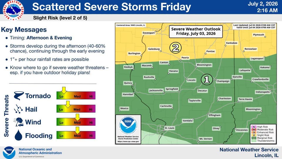
Updated Thursday, July 2 at 6:00 p.m.
From the National Weather Service in Central Illinois: Heat index values of 100-105 degrees will be common again on Friday, from late morning into early evening. Independence Day will also see a heat index around 100. However, an increase in clouds and rain chances may result in these being a bit lower on Saturday.
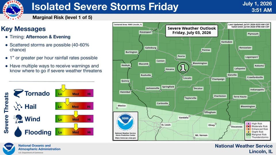
Updated Thursday, July 2 at 8:15 a.m.
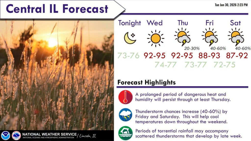
From IPM meteorologist Andrew Pritchard: Hot and humid conditions linger through the weekend, but storms return to the forecast tomorrow as well. Big time severe weather isn’t likely this weekend, but it’s possible a couple storms could become rowdy locally, or that we see a cluster of storms move in with heavy rain and gusty winds on Friday, Saturday, or Sunday. There should be plenty of opportunities for outdoor fun, but stay hydrated and keep an eye on the radar while you’re celebrating.


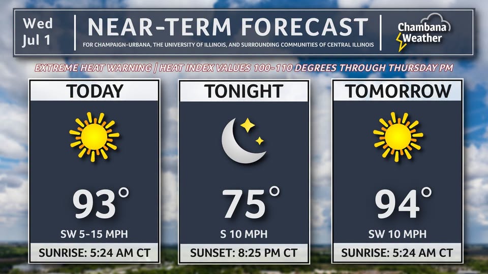
Updated Wednesday, July 1 at 8:40 a.m.
From IPM meteorologist Andrew Pritchard: Heat and humidity remains the main weather story with afternoon temps again climbing into the middle 90s today and tomorrow. As we head into the 4th of July holiday weekend look for hot and muggy conditions to continue, with a chance of summertime pop-up storm and storm clusters. The weekend won’t be a rain-out, but we’ll probably need to babysit the radar a little bit if you’ve got outdoor plans.

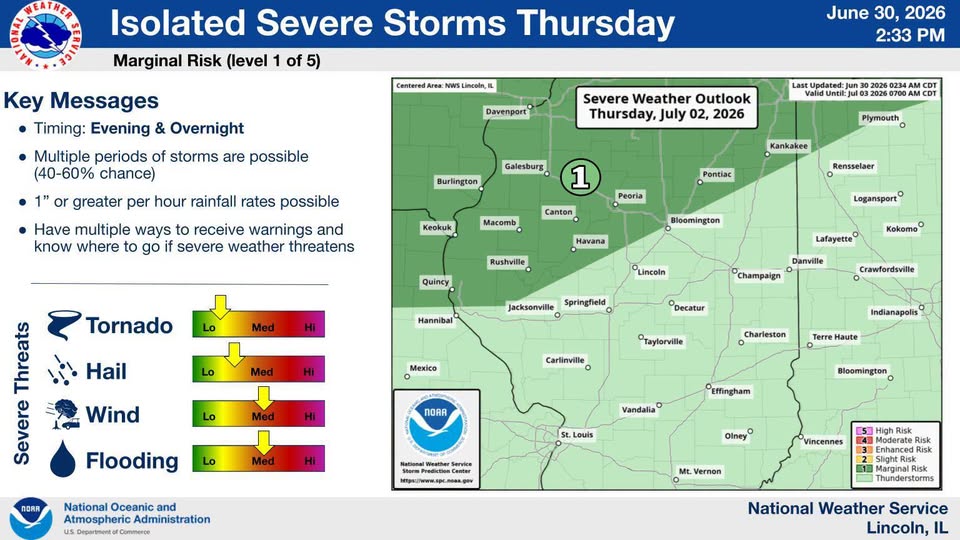
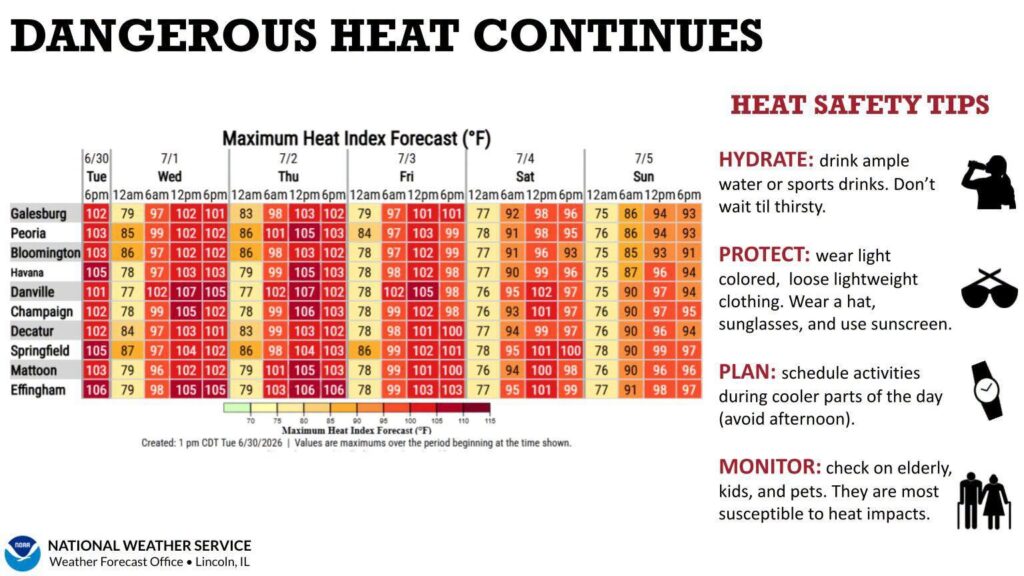
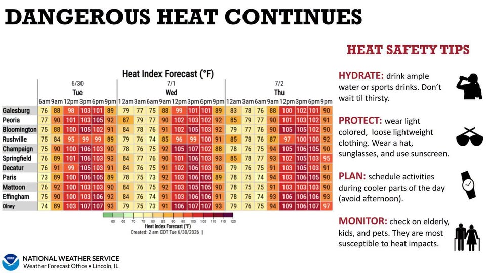
Updated Tuesday, June 30 at 8:00 p.m.
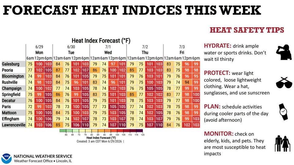
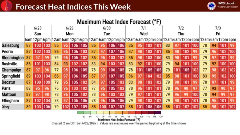
From the National Weather Service in Central Illinois: Daily heat index values are forecast to range from 100-110°F through Thursday. Less oppressive heat and humidity return to close the week as nearby thunderstorms introduce clouds and rain-cooled air.
Updated Tuesday, June 30 at 8:00 a.m.
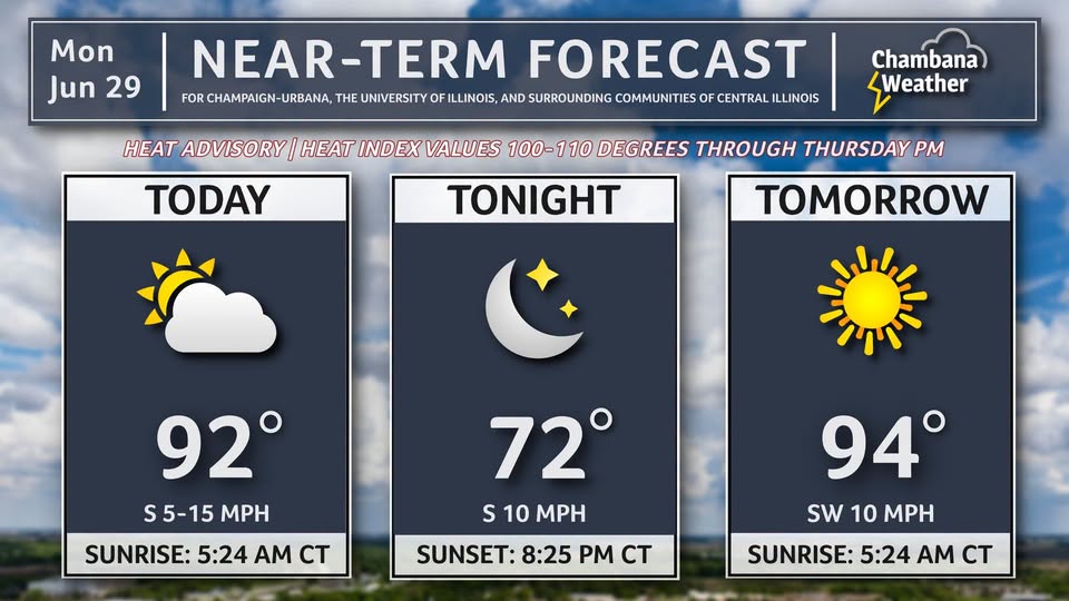
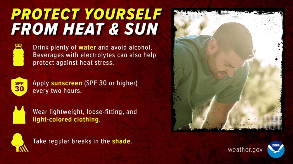
From IPM meteorologist Andrew Pritchard: An extreme heat warning is in effect through Thursday evening in Champaign County and surrounding areas of central Illinois. Afternoon temperatures will climb into the middle 90s each day this week with high humidity levels sending the heat index or what our bodies actually experience into the 100 to 110 degree range. Additionally, overnight lows will only fall into the middle 70s, making it difficult for those without access to air conditioning. To find relief, avoid strenuous outdoor work during the peak heating of the afternoon, wear light colored, loose-fitting clothing when outdoors, and drink plenty of fluids. Even with the extreme heat warning expiring on Thursday, expect a hot, muggy, and at times stormy Fourth of July holiday weekend.
Updated Monday, June 29 at 8:00 p.m.
Here’s a list of cooling centers:
| City | Hours | Addresses |
| Champaign | Normal Business Hours |
Public buildings, including libraries and municipal, state, and federal buildings |
| Champaign-Urbana | Various | |
|
Danville |
Mon-Thu 8am-7pm |
Danville Public Library, 319 N Vermilion |
|
|
Mon-Thu 8:30am-5pm |
Danville Rehabilitation Services, 407 N. Franklin Street |
|
|
Mon-Thu 5am-8pm |
Danville Family YMCA, 1111 N Vermilion |
|
|
Mon-Sun 10am-6:30pm |
Danville Men’s Rescue, 213 N Bowman Ave. |
Updated Monday, June 29 at 7:00 p.m.
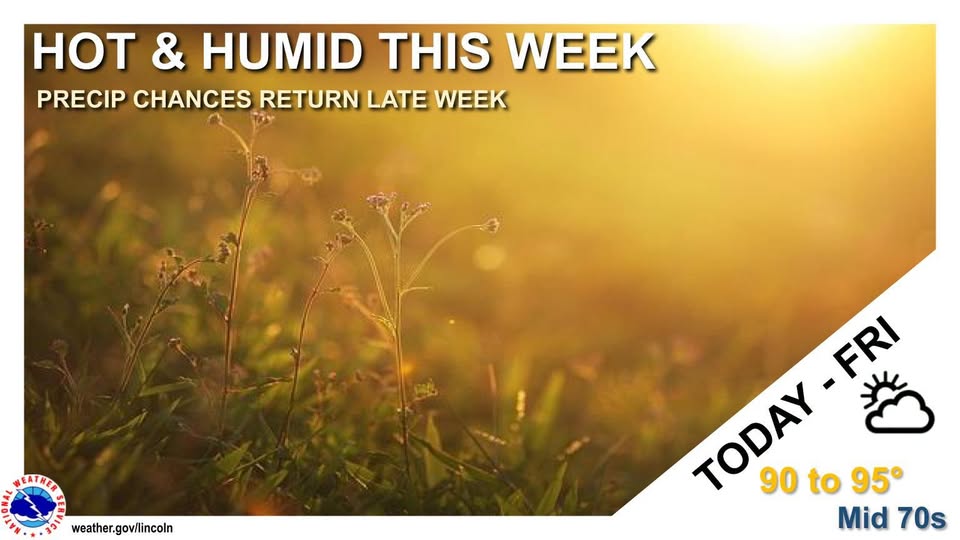
Hot and humid conditions will grip central Illinois through at least Thursday. During this time, daily temperatures will warm into the lower 90s and overnight lows will only fall into the mid-to-upper 70s.
Updated Monday, June 29 at 7:36 a.m.
Here’s the Monday morning forecast from IPM meteorologist Andrew Pritchard:
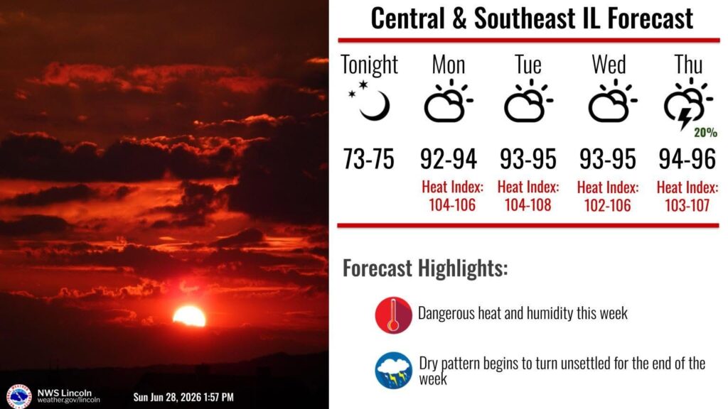
Updated Sunday, June 28 at 2:18 p.m.
From the National Weather Service in Central Illinois: Dangerous heat and humidity will dominate central and southeast Illinois. Hot and humid weather will dominate the area for the next several days.
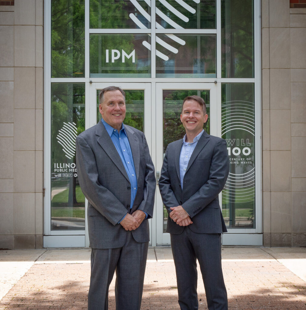
Meteorologist Ed Kieser returns to Illinois Public Media to team up with Andrew Pritchard on weather and severe storm coverage
URBANA – No, your ears were not deceiving you. Meteorologist Ed Kieser gave the forecast on Friday morning, June 26. After a 16-year break, WILL-AM/FM/TV’s former full-time meteorologist is back to team up with Andrew Pritchard.
During the summer and fall months, Kieser will fill-in when Andrew is on vacation. The duo will team up during emergency breaking weather, such as Tornado Warnings, Severe Thunderstorm Warnings, and other life-threatening weather hazards or when needed.
From January-June, Kieser will produce Monday-Thursday morning forecasts for local newscasts during NPR’s “Morning Edition” on WILL AM 580, WILL-FM 90.9, and Illinois Soul FM 101.1. Pritchard will produce morning forecasts on Fridays. It will allow him to concentrate on his full-time role at Nutrien, where he often travels long distances during the winter months. The duo will also team up when necessary to provide emergency breaking weather coverage.
Kieser spoke with IPM News and Public Affairs Director Reginald Hardwick about his return to the airwaves in Central Illinois.
Kieser was WILL’s second full-time meteorologist, succeeding Kirk Melhuish, later known as Kirk Mellish, who recently ended a long stint forecasting weather for WSB Radio in Atlanta. Before him, WILL received its weather forecasts from Mark Harrison, who also reported news, and Steve Hilberg, who worked nearby at the Illinois State Water Survey on the University of Illinois campus. From 1987 until WILL disbanded its weather department in 2010, Ed Kieser was joined by other meteorologists and forecasters, including Mike Sola and Scott Olthoff. But in a 2022 interview for Illinois Public Media, Kieser says he started out as the station’s sole staff meteorologist.
In 2025, Kieser retired as a meteorologist at an energy company in Columbus, Ohio. His interest in weather led to a bachelor’s degree and then a master’s degree in meteorology from The Pennsylvania State University. His master’s thesis advisor was Dr. Greg Forbes, former severe weather expert for The Weather Channel. While at Penn State, Ed took a few classes in broadcasting and worked part-time as television weather anchor/producer for WNEP-TV in Scranton, a country music deejay for WGMR-FM in State College, and news anchor/producer for WPSU-FM in State College.
Network of climate stations provide critical data, enable real-time decisions during severe weather
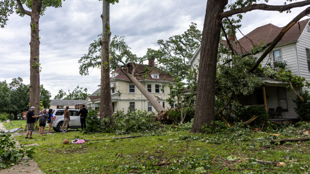
When severe weather hits Illinois – like the storms last week – a network of weather stations across the state collects data to inform real time safety decisions.
The Illinois Climate Network consists of 20 monitoring stations across the state that collect data on temperature, wind speed, precipitation and other parameters. Officials dedicated the most recent station last week in Charleston, just a day before a tornado touched down about half a mile away.
Prairie Research Institute at the University of Illinois Urbana-Champaign runs the network. One of its strengths compared to others is that it collects data every five minutes.
“We were sending the data to National Weather Service,” said Jennie Atkins, Manager of Water and Atmospheric Resources Monitoring Program, “and they could pull that with other to see what’s changing in real time.”
This network, also known as a mesonet, provides information to more than just Illinois, Atkins said.
“There are mesonets in Missouri and Iowa, so as systems are moving across the Midwest, they’re not only collecting data from us, they’re collecting it from our neighbors to the west,
she said. “And they’re collecting data from Illinois, which is helping the people in Indiana.”
But Atkins said there are still big gaps in the network, which is why Prairie Research Institute hopes to expand to 100 stations across the state.
“By having it closer to them, it’s going to provide more localized data, which is more meaningful to the communities and more helpful to the National Weather Service and others that are using the information,” she said.
Atkins said this data can save property and lives during severe weather events, especially as Illinois sees a massive increase in tornadoes.
The state typically averages about 54 tornadoes a year, but that number has skyrocketed since 2023, according to data from Prairie Research Institute. After tornadoes over the weekend that killed at least two people in southern Illinois, the state has surpassed 150 this year, State Climatologist Trent Ford said. That’s a new record for Illinois, which also leads the nation in number of tornadoes.